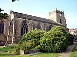
Orrell, Greater Manchester
Areas of Greater ManchesterGeography of the Metropolitan Borough of WiganUnparished areas in Greater Manchester

Orrell is a suburb of Wigan in the Metropolitan Borough of Wigan, Greater Manchester, England. The population of the ward had fallen at the 2011 Census to 11,513. The area lies 3 miles (4.8 km) to the west of Wigan town centre. The area is contiguous with Pemberton. Historically in Lancashire, Orrell was a centre of the coal mining industry, though today no evidence of the area's industrial past is present. The electoral ward of Orrell has a population of 11,203, however, the ward covers a larger area also containing parts of Billinge and Winstanley.
Excerpt from the Wikipedia article Orrell, Greater Manchester (License: CC BY-SA 3.0, Authors, Images).Orrell, Greater Manchester
Farm Meadow Road,
Geographical coordinates (GPS) Address Nearby Places Show on map
Geographical coordinates (GPS)
| Latitude | Longitude |
|---|---|
| N 53.5319 ° | E -2.7082 ° |
Address
Farm Meadow Road
Farm Meadow Road
WN5 8TE , Orrell Post
England, United Kingdom
Open on Google Maps


