place

Conservatorium van Amsterdam

1884 in the NetherlandsAmsterdam University of the ArtsConservatorium van AmsterdamMusic schools in the Netherlands
CVA33
CVA33

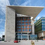
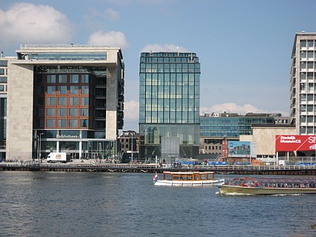
The Conservatorium van Amsterdam (CvA) is a Dutch conservatoire of music located in Amsterdam. This school is the music division of the Amsterdam University of the Arts, the city's vocational university of arts. The Conservatorium van Amsterdam is the largest music academy in the Netherlands, offering programs in classical music, jazz, pop, early music, music education, and opera.

Excerpt from the Wikipedia article Conservatorium van Amsterdam (License: CC BY-SA 3.0, Authors, Images).

Conservatorium van Amsterdam
Oosterdoksstraat, Amsterdam Centrum

Geographical coordinates (GPS) Address Nearby Places
placeShow on map

Wikipedia: Conservatorium van AmsterdamContinue reading on Wikipedia

Geographical coordinates (GPS)

Latitude Longitude
N 52.375833333333 ° E 4.9088888888889 °
placeShow on map

Address

Parking Centrum Oosterdok

Oosterdoksstraat 150
1011 DK Amsterdam, Centrum
North Holland, Netherlands
mapOpen on Google Maps

CVA33
CVA33
Share experience

Nearby Places

Prins Hendrikkade
Prins Hendrikkade

Prins Hendrikkade (Dutch for "Prince Henry's Quay") is a major street in the centre of Amsterdam. It passes Amsterdam Central Station, intersects the Damrak at the mouth of the Amstel river, and forms the southern end of the IJtunnel across the IJ bay. The street formed the northern edge and outer harbour of the city until the 19th century. It was named after Prince Henry of the Netherlands, youngest son of King William II, following Henry's death in 1879. The Prins Hendrikkade runs roughly northwest to southeast, from the northern end of Singel canal to Kattenburgerplein square. Car traffic is banned from the part of the street directly in front of Amsterdam Central Station, between Martelaarsgracht and Damrak. The street continues in westerly direction as Nieuwe Westerdokstraat and Haarlemmerhouttuinen. At the eastern end, the street turns north at Kattenburgerplein and continues as Kattenburgerstraat. The body of water between Prins Hendrikkade and the train station is known as Open Havenfront and, further east, as Oosterdok. Along the street are 99 buildings that have been listed as national monument (rijksmonument). Prominent buildings on the street include the Basilica of Saint Nicholas, the Schreierstoren, the Scheepvaarthuis, and Victoria Hotel. Along the eastern part of the street are a number of quays where houseboats are moored. Prins Hendrikkade has been depicted by various artists, including Claude Monet, who painted it in 1874.

IJtunnel
IJtunnel

The IJtunnel, opened on 30 October 1968, is an automobile tunnel under the IJ that connects the centre of Amsterdam with Amsterdam-Noord. The tunnel is part of a route across Amsterdam that connects the Ringweg North with the Ringweg South near Duivendrecht, via Nieuwe Leeuwarderweg, Valkenburgerstraat, Weesperstraat, Wibautstraat and Gooiseweg (S112). The total length of the tunnel, including on- and off-ramps, is 1682 metres. The covered part is 1039 metres long. The deepest point of the tunnel lies 20.32 metres below sea-level. The tunnel was built of sections of rectangular concrete constructions of 24.8 x 8.75 metres, subdivided into two tubes for automobile traffic and in between tubes for cables and pipes. Ventilators, located in two ventilation buildings on the banks of the IJ, blow clean air into the traffic areas via tubes under the surface of the road and openings in the tunnel walls, and suck polluted air out. At the entrance on the north side there are sun-blocking lattices over the road. These lattices are missing on the south side, where the Nemobuilding is built on top of the tunnel. The traffic in the tunnel is monitored by 22 closed-circuit cameras. A heating system prevents the forming of ice on the surface of the road, and a computer regulates the intensity of light at the beginning and the end of the tunnel, so that a gradual transition from tunnel light to daylight takes place. The route through the IJtunnel is an urban avenue, formed out of two divided tunnels, each with two lanes of traffic. This four-lane road continues to the A10 in the north and to the Prins Hendrikkade in the south, where it is reduced to two lanes, one in each direction.