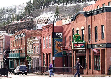
Central City/Black Hawk Historic District
Black Hawk, ColoradoBuildings and structures in Gilpin County, ColoradoCentral City, ColoradoGeography of Gilpin County, ColoradoHistoric districts on the National Register of Historic Places in Colorado ... and 5 more
NRHP infobox with nocatNational Historic Landmark DistrictsNational Historic Landmarks in ColoradoNational Register of Historic Places in Gilpin County, ColoradoUse mdy dates from August 2023

The Central City/Black Hawk Historic District (formerly just the Central City Historic District) is a National Historic Landmark District that encompasses the developed areas of Central City and Black Hawk, Colorado, United States. They are adjacent former gold mining camps in the Front Range of the Rocky Mountains in Gilpin County, Colorado. For a time, the area was known as the Richest Square Mile on Earth, and was the largest urban area of the Colorado Territory in the 1870s. The district was designated a National Historic Landmark on July 4, 1961, for its well-preserved early mining community architecture and history.
Excerpt from the Wikipedia article Central City/Black Hawk Historic District (License: CC BY-SA 3.0, Authors, Images).Central City/Black Hawk Historic District
East 1st High Street,
Geographical coordinates (GPS) Address Nearby Places Show on map
Geographical coordinates (GPS)
| Latitude | Longitude |
|---|---|
| N 39.801111111111 ° | E -105.5075 ° |
Address
East 1st High Street 340
80427
Colorado, United States
Open on Google Maps


