Church Minshull

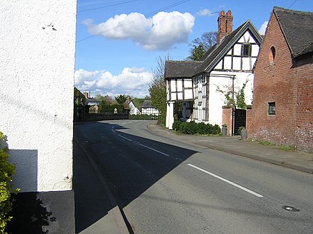
Church Minshull is a village and civil parish in the unitary authority of Cheshire East and the ceremonial county of Cheshire, England. The village is approximately 5 miles (8.0 km) north west of Crewe, just west of the River Weaver and Shropshire Union Canal. The principal road through Church Minshull is the B5074 between Nantwich (6 miles to the south) and Winsford (4 miles to the north). The modern village centre is a designated conservation area which contains many houses of Tudor style architecture. A large area in the east of the parish falls within the Weaver Valley Area of Special County Value.The population at the 2001 Census was 431, living in 196 residences of which sixty are on Home Farm Park and twenty on Village Farm. The parish is made up of 2,285 acres (9.25 km2). The population at the 2011 Census had reduced slightly to 426.
Excerpt from the Wikipedia article Church Minshull (License: CC BY-SA 3.0, Authors, Images).Church Minshull
Nantwich Road,
Geographical coordinates (GPS) Address Nearby Places Show on map
Geographical coordinates (GPS)
| Latitude | Longitude |
|---|---|
| N 53.14 ° | E -2.5 ° |
Address
Church Minshull Village Hall
Nantwich Road
CW5 6DZ , Church Minshull
England, United Kingdom
Open on Google Maps


