place

Blennerhassett Island Bridge

2008 establishments in Ohio2008 establishments in West VirginiaBlennerhassett IslandBridges completed in 2008Bridges of the United States Numbered Highway System
Bridges over the Ohio RiverBuildings and structures in Washington County, OhioBuildings and structures in Wood County, West VirginiaNetwork arch bridgesRoad bridges in OhioRoad bridges in West VirginiaSouthern United States bridge (structure) stubsSteel bridges in the United StatesTied arch bridges in the United StatesTransportation in Washington County, OhioTransportation in Wood County, West VirginiaU.S. Route 50West Virginia building and structure stubsWest Virginia transportation stubs
Blennerhassett Bridge 033

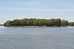
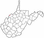
Blennerhassett Island Bridge, with a network arch design, carries U.S. Route 50 (Appalachian Development Highway System's Corridor D) over the Ohio River and the historic Blennerhassett Island between Belpre Township, Ohio and Washington, West Virginia in the United States. Construction of the bridge was overseen by the Walsh Construction Company of Chicago, and it opened to traffic on June 13, 2008. The completion of the span completed Corridor D between Interstate 275 east of Cincinnati to Interstate 79 at Clarksburg, West Virginia.

Excerpt from the Wikipedia article Blennerhassett Island Bridge (License: CC BY-SA 3.0, Authors, Images).

Blennerhassett Island Bridge
Blennerhassett Island Bridge,

Geographical coordinates (GPS) Address Nearby Places
placeShow on map

Wikipedia: Blennerhassett Island BridgeContinue reading on Wikipedia

Geographical coordinates (GPS)

Latitude Longitude
N 39.276666666667 ° E -81.646944444444 °
placeShow on map

Address

Blennerhassett Island Bridge

Blennerhassett Island Bridge
26181
West Virginia, United States
mapOpen on Google Maps

Blennerhassett Bridge 033
Share experience

Nearby Places

Little Hocking River

The Little Hocking River is a small tributary of the Ohio River, 18.4 miles (29.6 km) long, in southeastern Ohio in the United States. Via the Ohio River, it is part of the watershed of the Mississippi River, draining an area of 102 square miles (260 km2) on the unglaciated portion of the Allegheny Plateau. The river flows for its entire length in southwestern Washington County; its tributaries also drain a small area of southeastern Athens County.The Little Hocking River begins in Fairfield Township between the communities of Barlow and Bartlett and initially flows southeastward through southwestern Barlow Township into Dunham Township, where it is dammed to form Veto Lake, which is surrounded by the 160-acre (0.65 km2) Veto Lake State Wildlife Area. Downstream of Veto Lake, the river flows southwestward into Belpre Township; near its mouth it turns eastward and flows into the Ohio River at the community of Little Hocking.Among the Little Hocking River's tributaries are three with names derived from that of the main stream: The East Branch Little Hocking River begins at 39°23′06″N 81°32′45″W in Warren Township and flows southwestward to 39°20′05″N 81°38′08″W in Dunham Township. It is 6.8 miles (10.9 km) long and drains an area of 13 square miles (34 km2). The Little West Branch Little Hocking River begins at 39°21′28″N 81°43′06″W in Fairfield Township and flows southward through Decatur Township to 39°17′02″N 81°42′40″W in Belpre Township. It is 6 miles (9.7 km) long and drains an area of 9.46 square miles (24.5 km2). The West Branch Little Hocking River begins at 39°24′19″N 81°49′28″W in near Bartlett in Wesley Township and flows south-southeastward through Fairfield and Decatur Townships to 39°16′38″N 81°42′41″W in Belpre Township. It is 18 miles (29 km) long and drains an area of 39.4 square miles (102 km2).According to the Geographic Names Information System, the Little Hocking River has also been known historically as "Little Hockhocken River," "Little Hockhockin River," and "Little Hockhocking River."

Sawyer–Curtis House
Sawyer–Curtis House

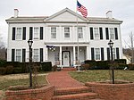
The Sawyer–Curtis House is a historic residence in the community of Little Hocking in Washington County, Ohio, United States. Located along the Ohio River in southern Belpre Township below the city of Belpre, Little Hocking was settled shortly before 1800. The earliest settler in the vicinity of Little Hocking was Nathaniel Sawyer, a native of Massachusetts who erected a New England–style of house there in 1798. Now known as the Sawyer–Curtis House, it is believed to have been the first permanent structure to be erected anywhere in Belpre Township. Sawyer's house is a weatherboarded structure with a tin roof and a foundation of sandstone. Built around a frame of logs, it is constructed with a typical New England floor plan, with its most significant individual feature being a massive chimney at the center of the house.Besides serving as Sawyer's home, the house has served a range of purposes over the past two centuries. Among the other individuals who have lived there is its other namesake, Horace Curtis, who was one of the leading members of Washington County society in his day. Its uses have not been restricted to residential purposes: it has also been used as a post office and as a store, although it is currently used as a residence. In 1984, the house was listed on the National Register of Historic Places, along with one related building; it qualified for this designation because of its historically significant architecture and its place as the home of one of the area's leading citizens.