Strathbungo

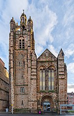
Strathbungo is a mainly residential area of southern Glasgow, Scotland, bordered by the neighbourhoods of Crossmyloof to the south, Govanhill to the east and Pollokshields to the north and west. The settlement grew up as a small isolated village built along the Pollokshaws Road, one of the main arteries leading southwards from the centre of Glasgow (today part of the A77 road), adjoined by the Camphill Estate, now part of Queens Park. Strathbungo lay just inside Govan parish, on its boundary with Cathcart parish, and at one time a line just north of Allison Street and Nithsdale Street formed the boundary or 'march' between the counties of Lanark and Renfrew. The feudal superiors, the Maxwells of Pollok, preferred the name Marchtown. This name is seen on some old maps, and survives in March Street.
Excerpt from the Wikipedia article Strathbungo (License: CC BY-SA 3.0, Authors, Images).Strathbungo
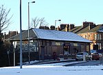
Nithsdale Road, Glasgow Strathbungo
Geographical coordinates (GPS) Address Nearby Places Show on map
Geographical coordinates (GPS)
| Latitude | Longitude |
|---|---|
| N 55.83654 ° | E -4.27057 ° |
Address
Nithsdale Road 4-8
G41 2AE Glasgow, Strathbungo
Scotland, United Kingdom
Open on Google Maps


