place

Steiner, Michigan

1873 establishments in MichiganFormer villages in MichiganPopulated places established in 1873Southeast Michigan geography stubsUnincorporated communities in Michigan
Unincorporated communities in Monroe County, Michigan
Steiner MI Depot Pere Marquette Railroad

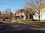
Steiner was a small farming settlement in what is now Frenchtown Charter Township, Monroe County in the U.S. state of Michigan. The village no longer exists but some structures remain and are in use. It was situated at the intersection of Steiner Road and Laduke Road near the current CSX Railroad crossing at 41°59′20″N 83°23′15″W.The village of Steiner was located about five miles north of Monroe Michigan, and was centered around the Steiner Depot of the Pere Marquette Railroad. Steiner was founded by and named for William Steiner in 1873. A post office opened on September 7, 1886 with John Kohler as the first postmaster. The office closed on July 31, 1925.At one time the town had a railroad depot, creamery, granary, freight scales, a saw-mill, basket factory, pottery and brick works, a saloon (the Steiner Inn), the Laduke general store and the Steiner Post Office. For some years the railroad maintained a spur extending west from a siding in Steiner to a sand quarry near Maybee, Michigan. The general store and other structures, located between Laduke Roads and the railroad tracks were destroyed in a fire on May 3 of 1948. An elderly woman, Mrs. Margaret Gibson, age 70 and Magadline Moyer, age 5 perished in the fire. There was a significant delay in the arrival of rescuers, as the closest fire department was located five miles south, in Monroe. Few obvious signs remain today of this town except a cluster of several pre-1900 houses, the basket factory building near the railroad tracks, and the road name. Steiner is now one of the lost cities, towns, and counties of Michigan

Excerpt from the Wikipedia article Steiner, Michigan (License: CC BY-SA 3.0, Authors, Images).

Steiner, Michigan
Steiner Road,

Geographical coordinates (GPS) Address Nearby Places
placeShow on map

Wikipedia: Steiner, MichiganContinue reading on Wikipedia

Geographical coordinates (GPS)

Latitude Longitude
N 41.988888888889 ° E -83.3875 °
placeShow on map

Address

Steiner Road 801
48162
Michigan, United States
mapOpen on Google Maps

Steiner MI Depot Pere Marquette Railroad
Share experience

Nearby Places

St. Mary's Church Complex Historic District (Monroe, Michigan)

The St. Mary's Church Complex Historic District is a historic district located at the junction of Elm Avenue and North Monroe Street (M-125) in the city of Monroe, Michigan. It was listed as a Michigan Historic Site and added to the National Register of Historic Places on May 6, 1982.The complex itself consists of four buildings. The centerpiece of the district is St. Mary Church at 117 North Monroe Street. The church traces its origins to the St. Antoine aux Rivière Raisin, which was founded on October 15, 1788, and it is the oldest church in Monroe County. The current site was constructed in 1834, consecrated in 1839, and renamed in 1845. That year, the church fell under the leadership of the Roman Catholic Archdiocese of Detroit, and the Sisters, Servants of the Immaculate Heart of Mary was founded in Monroe the same year. In 1846, St. Mary Academy was an all-girls educational facility built down the road from the church, while Monroe Catholic Central was an all-boys school built right next to the main church. These two schools merged in 1986 to form the coeducational St. Mary Catholic Central (SMCC) high school, which stayed in the heavily expanded Monroe Catholic Central building next to the church at 108 West Elm Avenue. It remains there to this day as the largest building in the historic district and the largest private school in the county.The original church building remained unchanged from its completion in 1839 until it was expanded in 1903. The Brothers of the Holy Cross residential building was constructed in 1870, and the St. Mary Parochial Elementary School was completed in 1903. The current rectory was added to the north side of the church in the 1920s. All of these buildings have their own unique architecture. With only some additions to the SMCC building, the remaining buildings on the complex have remained largely unchanged since the 1920s. The St. Mary's Church Complex Historic District is bordered to the west by Borgess Avenue, to the north by West Willow Street, to the south by Elm Avenue, and to the east by North Monroe Street (M-125) for an area of about 60 acres (24 hectares). The district is located across Elm Avenue from the George Armstrong Custer Equestrian Monument and across North Monroe Street from the East Elm-North Macomb Street Historic District. The church complex is also located just across the River Raisin from the Old Village Historic District.