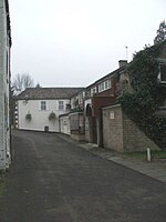
Tanfield Lea
County Durham geography stubsStanley, County DurhamVillages in County Durham

Tanfield Lea is a village north of Stanley, County Durham, England, and south of Tantobie.
Excerpt from the Wikipedia article Tanfield Lea (License: CC BY-SA 3.0, Authors, Images).Tanfield Lea
Tanfield Lea Road,
Geographical coordinates (GPS) Address Nearby Places Show on map
Geographical coordinates (GPS)
| Latitude | Longitude |
|---|---|
| N 54.88 ° | E -1.71 ° |
Address
Tanfield Lea Road
Tanfield Lea Road
DH9 9LJ
England, United Kingdom
Open on Google Maps


