place

Terrapin Point

Buildings and structures in Niagara Falls, New YorkNiagara FallsTourist attractions in Niagara County, New York
Drawing, Niagara River and Falls in Snow, March 1856 (CH 18201549)

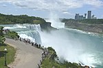
Terrapin Point (formerly Terrapin Rocks) is an observation area located in Niagara Falls, New York at the western tip of Goat Island, next to the Canadian Horseshoe Falls. It is one of two major observation areas to overlook the falls and lower Niagara Gorge on the New York side, the other being Prospect Point further downriver. Before the second half of the 20th century Terrapin Point was a group of rocks on the brink of the falls, disconnected from Goat Island. They were known as the Terrapin Rocks because they resembled giant tortoises.In 1827, the then owners of the land on the American side, brothers Peter and Augustes Porter, built a 300-foot wooden bridge from Goat Island to just off the edge of the falls. In 1833, they added a lighthouse-like building, Terrapin Tower, to this viewpoint. Its height is estimated at 30 to 45 feet, its diameter at 12 feet. A spiral staircase inside allowed visitors to reach a viewing platform. Although the tower quickly attracted many visitors, there were also critical voices that found it disturbing in view of the beauty of the waterfalls. In 1873 the Porter brothers lost interest in the Terrapin Tower and blew it up. The bridge lasted longer. It can still be seen in photos from 1934. By 1954, however, it had also disappeared.While work was being carried out on the dredging of the upper Niagara River in 1954–1955 to spread the flow of water more evenly along the crest of the Horseshoe Falls, dirt and fill from the dredging was taken over to Terrapin Point, increasing its area and affording visitors views of the cataract not seen before. the Terrapin Point fill area was turned over to the New York State Division of Parks on 3 November 1955. However, this area was closed to tourists after 1969, due to cracks being found in the rock foundation. In 1983 the United States Army Corps of Engineers blasted away 25,000 tons of unstable rock, added more landfill, and built diversion dams and retaining walls to force the water away from Terrapin Point. Altogether 400 feet (120 m) of the Horseshoe Falls was eliminated, including 100 feet (30 m) on the Canadian side. According to author Ginger Strand, the Horseshoe Falls is now entirely in Canada. Other sources say "most of" Horseshoe Falls is in Canada. The remaining surface was scaled, and reopened to tourists in September 1983. It was off Terrapin Point that daredevil Nik Wallenda began his high-wire walk over the Falls in June 2012. Wallenda was the first to walk a high-wire directly over the brink of the Falls.

Excerpt from the Wikipedia article Terrapin Point (License: CC BY-SA 3.0, Authors, Images).

Terrapin Point
Goat Island Road, City of Niagara Falls

Geographical coordinates (GPS) Address Nearby Places
placeShow on map

Wikipedia: Terrapin PointContinue reading on Wikipedia

Geographical coordinates (GPS)

Latitude Longitude
N 43.080069 ° E -79.074403 °
placeShow on map

Address

Goat Island Road
14302 City of Niagara Falls
New York, United States
mapOpen on Google Maps

Drawing, Niagara River and Falls in Snow, March 1856 (CH 18201549)
Share experience

Nearby Places

Niagara Falls
Niagara Falls

Niagara Falls () is a group of three waterfalls at the southern end of Niagara Gorge, spanning the border between the province of Ontario in Canada and the state of New York in the United States. The largest of the three is Horseshoe Falls, which straddles the international border of the two countries. It is also known as the Canadian Falls. The smaller American Falls and Bridal Veil Falls lie within the United States. Bridal Veil Falls is separated from Horseshoe Falls by Goat Island and from American Falls by Luna Island, with both islands situated in New York. Formed by the Niagara River, which drains Lake Erie into Lake Ontario, the combined falls have the highest flow rate of any waterfall in North America that has a vertical drop of more than 50 m (160 ft). During peak daytime tourist hours, more than 168,000 m3 (5.9 million cu ft) of water goes over the crest of the falls every minute. Horseshoe Falls is the most powerful waterfall in North America, as measured by flow rate. Niagara Falls is famed for its beauty and is a valuable source of hydroelectric power. Balancing recreational, commercial, and industrial uses has been a challenge for the stewards of the falls since the 19th century. Niagara Falls is 27 km (17 mi) northwest of Buffalo, New York, and 69 km (43 mi) southeast of Toronto, between the twin cities of Niagara Falls, Ontario, and Niagara Falls, New York. Niagara Falls was formed when glaciers receded at the end of the Wisconsin glaciation (the last ice age), and water from the newly formed Great Lakes carved a path over and through the Niagara Escarpment en route to the Atlantic Ocean.

Niagara River
Niagara River

The Niagara River () is a river that flows north from Lake Erie to Lake Ontario. It forms part of the border between the province of Ontario in Canada (on the west) and the state of New York in the United States (on the east). There are differing theories as to the origin of the river's name. According to Iroquoian scholar Bruce Trigger, Niagara is derived from the name given to a branch of the locally residing native Neutral Confederacy, who are described as being called the Niagagarega people on several late-17th-century French maps of the area. According to George R. Stewart, it comes from the name of an Iroquois town called Ongniaahra, meaning "point of land cut in two".The river, which is occasionally described as a strait, is about 58 kilometres (36 mi) long and includes Niagara Falls in its course. The falls have moved approximately 11 kilometres (6.8 mi) upstream from the Niagara Escarpment in the last 12,000 years, resulting in a gorge below the falls. Today, the diversion of the river for electrical generation has significantly reduced the rate of erosion. The total drop in elevation along the river is 99 metres (325 ft). The Niagara Gorge extends downstream from the Falls and includes the Niagara Whirlpool and another section of rapids. Power plants on the river include the Sir Adam Beck Hydroelectric Power Stations (built in 1922 and 1954) on the Canadian side, and the Robert Moses Niagara Power Plant (built in 1961) on the American side. Together, they generate 4.4 gigawatts of electricity. The International Control Works, built in 1954, regulates the river flow. Ships on the Great Lakes use the Welland Canal, part of the Saint Lawrence Seaway, on the Canadian side of the river, to bypass Niagara Falls. The Niagara River also features two large islands and numerous smaller islands. Grand Island and Navy Island, the two largest islands, are on the American and Canadian sides of the river, respectively. Goat Island and the tiny Luna Island split Niagara Falls into its three sections, the Horseshoe Falls, Bridal Veil Falls, and American Falls. Unity Island lies further upstream, alongside the city of Buffalo. The Niagara River and its tributaries, Tonawanda Creek and the Welland River, formed part of the last section of the Erie Canal and Welland Canal. After leaving Lockport, New York, the Erie Canal proceeds southwest until it enters Tonawanda Creek. After entering the Niagara River, watercraft then proceed southward to the final lock, where a short section of the canal allows boats to avoid the turbulent shoal water at the river intake and enter Lake Erie. The Welland Canals used the Welland River as a connection to the Niagara River south of the falls, allowing water traffic to safely re-enter the Niagara River and proceed to Lake Erie.