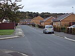
Upton, Merseyside

Upton is a village in the northern part of the Wirral Peninsula, England, and is situated within 4 miles (6.4 km) of Birkenhead, 4 miles (6.4 km) of the Dee Estuary, a similar distance from the River Mersey, and 2 miles (3.2 km) from Liverpool Bay. The village is a ward of the Metropolitan Borough of Wirral in the metropolitan county of Merseyside. Upton was in the traditional county of Cheshire. At the 2011 census, the population was 16,130. Upton was originally settled as an Anglo-Saxon farming community, and remained as a farming community until the village's rapid urbanisation and expansion from the mid-19th century. This was brought about by the development of Liverpool as a major port, with rail and road links across the Mersey estuary. The village now has a strong service economy which is based primarily around healthcare and retail, with a variety of places nearby, and within the village, to pursue sport and leisure activities.
Excerpt from the Wikipedia article Upton, Merseyside (License: CC BY-SA 3.0, Authors, Images).Upton, Merseyside
Arrowe Park Road, Wirral
Geographical coordinates (GPS) Address Nearby Places Show on map
Geographical coordinates (GPS)
| Latitude | Longitude |
|---|---|
| N 53.385 ° | E -3.099 ° |
Address
Arrowe Park Road
Arrowe Park Road
CH49 0UB Wirral
England, United Kingdom
Open on Google Maps


