place

RAF Winkton

Airfields of the IX Fighter Command in the United KingdomMilitary units and formations disestablished in 1945Military units and formations established in 1943Royal Air Force stations in DorsetRoyal Air Force stations in Hampshire
Use British English from October 2017
Winkton jan47
Winkton jan47

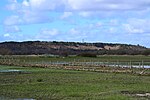
Royal Air Force Winkton or more simply RAF Winkton is a former Royal Air Force Advanced Landing Ground previously in Hampshire but now, due to County boundary changes, in Dorset, England. The airfield is located approximately 3 miles (4.8 km) north of Christchurch; about 89 miles (143 km) southwest of London, and is named after the nearby hamlet of Winkton. Although complete by September 1943 Winkton opened in March 1944 with Sommerfeld Mesh runways and pierced steel planking perimeter tracks, and was the prototype for the type of temporary Advanced Landing Ground type airfield that would be built in France after D-Day, when the need for advanced landing fields would become urgent as the Allied forces moved east across France and Germany. It was used by British, Dominion and the United States Army Air Forces. It was closed in July 1944, when the mesh runways were lifted for use on the Continent, and immediately returned to agriculture. Today the airfield is a mixture of agricultural fields with no recognizable remains.

Excerpt from the Wikipedia article RAF Winkton (License: CC BY-SA 3.0, Authors, Images).

RAF Winkton
Derritt Lane, New Forest Sopley

Geographical coordinates (GPS) Address Nearby Places
placeShow on map

Wikipedia: RAF WinktonContinue reading on Wikipedia

Geographical coordinates (GPS)

Latitude Longitude
N 50.776944444444 ° E -1.7672222222222 °
placeShow on map

Address

Derritt Lane

Derritt Lane
BH23 8AP New Forest, Sopley
England, United Kingdom
mapOpen on Google Maps

Winkton jan47
Winkton jan47
Share experience

Nearby Places

Burton, Dorset
Burton, Dorset

Burton is a village in the civil parish of Burton and Winkton, administered (since April 2019) as part of the Bournemouth, Christchurch and Poole unitary authority, in the historic county of Hampshire and the ceremonial county of Dorset, England. The parish is elevated above the Avon Valley on a gravel plateau and includes the village of Burton, plus the hamlets of Winkton, Holfleet, North Bockhampton, Middle Bockhampton and South Bockhampton. The toponymy of Burton suggests an Anglo-Saxon settlement but the first record of the name appears in twelfth-century records. It is thought that this is because it has always been viewed as an extension of Christchurch. Certainly, there is evidence of human habitation there as far back as the mesolithic. The oldest existing parts date back to at least the early 18th century. Greatly expanded in the 1970s, today the population is around 4,000, residing in more than 1,700 dwellings which extend to within 3⁄4 mile (1.2 km) of the Christchurch urban area. Burton has a much younger age demographic than the rest of Christchurch and the vast majority of the inhabitants identify as White British. More than 30% of villagers are non-religious but those who are, are mainly Christian. The village holds a number of annual events including a veteran's day and an Easter egg hunt. Church services are also held on the green at Easter and Christmas including carols around the tree. There are a number of listed buildings in the village including the parish church of St Luke, built in 1874-75 and designed by Benjamin Ferrey, and Burton Hall, a large 18th-century residence with grade II* status. Arguably Burton's most famous resident was the poet and writer Robert Southey who lived there between 1799 and 1805 and where he wrote his well known fairytale, Goldilocks and the Three Bears.