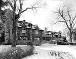
place

Louviers, Colorado

1906 establishments in ColoradoCensus-designated places in ColoradoCensus-designated places in Douglas County, ColoradoDenver metropolitan areaUse mdy dates from July 2023
Louviers, Colorado
Louviers, Colorado

Louviers is an unincorporated town, a post office, and a census-designated place (CDP) located in and governed by Douglas County, Colorado, United States. The CDP is a part of the Denver–Aurora–Lakewood, CO Metropolitan Statistical Area. The Louviers post office has the ZIP Code 80131 (post office boxes). At the United States Census 2020, the population of the Louviers CDP was 293.

Excerpt from the Wikipedia article Louviers, Colorado (License: CC BY-SA 3.0, Authors, Images).

Geographical coordinates (GPS)

Latitude Longitude
N 39.4798657 ° E -105.0033404 °
placeShow on map

Address


80125
Colorado, United States
mapOpen on Google Maps

Louviers, Colorado
Louviers, Colorado
Share experience

Nearby Places

Louviers Village Club

The Louviers Village Club, in Louviers, Colorado, was built in 1917 and was listed on the National Register of Historic Places in 1995.It was built by E.I. du Pont de Nemours and Company to serve as a community building in the company town of Louviers. It is a U-shaped building, built in Craftsman style. It was deemed significant for NRHP listing "for its association with the explosive industry's contribution to the development of the West, social history as illustrated by the company town movement, and for the information it provides regarding entertainment and recreation in the early Twentieth Century. During the Nineteenth and early Twentieth Centuries, E. I. du Pont de Nemours and Company pioneered the development and manufacture of explosives in the United States. Business was brisk for the Du Pont Powder Company by the early Twentieth Century, when dynamite products were in great demand for use in mining and in railroad, tunnel and road construction. Du Pont, the nation's leading supplier of explosives at the time, was unable to fill all of the orders for its products. In order to expand its production capabilities, Du Pont sought new sites for the establishment of explosives plants. The company was particularly desirous of locating a plant in the Rocky Mountain region due to the fact that there were then no sources for explosives closer than the West Coast or the Mississippi River. In 1906, Du Pont procured a site on Plum Creek adjacent to the Denver and Rio Grande Railroad line. First called "Toluca" after a station on the line, the name was quickly changed to "Louviers" after the ancestral home in France of the DuvPont family. Dynamite production at Louviers began in 1908, with over a half million pounds produced the first year. By 1951, "Louviers Works", as the plant was called, produced over two million pounds of dynamite per month and employed 230 workers. In 1971, after the production of an estimated one billion pounds of dynamite, the company shifted emphasis to production of PETN and a new emulsion explosive product. Operations at the plant ceased in the early 1980s. The plant facilities were extensively modified over time in keeping with technological advances, and are still maintained by Du Pont on a care taking basis. Du Pont retains ownership of the majority of land immediately surrounding the town of Louviers."

Santa Fe Railway Water Tank

The Santa Fe Railway Water Tank, or Sedalia Water Tank, on the railway through Sedalia, Colorado in Douglas County, Colorado, is a historic object listed on the National Register of Historic Places. It is a cylindrical water tank 24 feet (7.3 m) in diameter, 43 feet (13 m) tall, with capacity of 140,000 US gallons (530 m3), upon a slag foundation, built in 1906. Per its NRHP nomination, it was installed by the Denver and Santa Fe Railway Company, a subsidiary of the Atchison, Topeka and Santa Fe Railway (AT&SF), an early railroad which built track through the area in 1887. It provided water for coal-powered steam locomotives from 1906 until 1950 when its "stand pipe" was removed, after water was no longer needed (when diesel locomotives had replaced steam ones). It was described in its NRHP nomination as follows: It was deemed significant "for its association with the operation of the Atchison, Topeka and Santa Fe Railway (AT&SF), an early railroad that constructed its track through the area in 1887. The tank provided water for the coal-fired steam locomotives that ran the line. At the end of WW II, diesel engines began replacing steam locomotives, and the need for large water tanks at frequent intervals along the rails diminished. Most steam locomotives were retired by the 1950s. It was later deeded to the Sedalia Water and Sanitation District for the community’s water supply. The period of significance began with the construction of the tank in 1906 and ended in 1950 when the stand pipe was removed. The steel tank also meets the registration requirements under criterion C for it represents a distinctive design and construction method. In the 19th and early 20th centuries, water stations usually consisted of elevated wooden water tanks. Steel tanks began to replace wood on some railroads after the turn of the century. The steel tank at Sedalia is an early example of the evolving technology, and it is believed to be one of the last surviving steel water tanks in the state."It is located within the railway right-of-way, about 200 yards (180 m) west of the intersection of U.S. Route 85 with State Highway 67 U.S. Route 85. It is closer to U.S. 85 and directly visible from that highway. It is also visible from Colorado State Highway 67, at least from its crossing of the rail tracks.

Cherokee Ranch
Cherokee Ranch

Cherokee Ranch, in Douglas County, Colorado near Sedalia, has been a purebred cattle ranch since 1954, including raising Santa Gertrudis cattle. The ranch is private property but offers frequent public and private events and tours. The property overlaps with portions of the Cherokee Ranch petrified forest.A large portion of the ranch was listed on the National Register of Historic Places in 1994. The listing included 19 contributing buildings, five contributing structures, a contributing site, and a contributing object on 3,280 acres (13.3 km2). The buildings are distributed among four historic building groups created by two homesteaders and a rich heiress. The four groups are: Ranch Headquarters, originally the John Blunt Homestead and later known as Amnicola Cherokee Castle the Flower Homestead (Chickamauga), and the Johnson ranch buildings.The first part of the property eventually assembled was 160 acres (0.65 km2) homesteaded by Maine-born John E. Blunt. A former Union soldier, he arrived with his family in 1868 from Kansas in a covered wagon which brought apple tree slips. He settled on land along East Plum Creek at homestead site now on the south side of U.S. Highway 85. It was extremely cold in winters along the creek, so they moved to higher ground in 1873 and built a wood-frame house at the current location of ranch headquarters. An original apple tree brought to the new site survived in 1994. Blunt acquired others' homestead properties and eventually what he called Sunflower Ranch had 1,550 acres (6.3 km2) on which he farmed wheat, sorghum, and steers. The ranch was sold by Ray Blunt in 1954 to Mildred Montague Genevieve Kimball, known as "Tweet", who chose to call it Amnicola after her property in Chattanooga on the Tennessee River. Tweet Kimball, known as "a delightfully eccentric international traveler, philanthropist, equestrian, award-winning cattlewoman and legendary hostess", lived 55 years in Cherokee Castle.Her first of four husbands was Merritt Kirk Ruddock, of aristocratic family and C.I.A. connections.The ranch has 4,185 acres (16.94 km2) on both south and north of U.S. Highway 85, but the listing is limited to the property north of 85, which includes four historic building groups. The four are: Cherokee Castle, originally known as Charlford Castle, which is a 20th-century copy of a 15th-century Scottish castle. It is the main residence of the ranch and was built during 1926–28. It was designed by Denver architect Burnham F. Hoyt, who is known for his later design of the Red Rocks Park Amphitheater.the Flower Homestead (Chickamauga), began with English-born Frederick Gerald Flower ploughing 12 acres (4.9 ha) of land and stringing barbed wire and then, in 1894, filing a homestead claim. He built a stone house on the edge of a high plateau with views of the Front Range, and his wife and sister moved there in 1895. His remote property was accessed by a track which later became Daniels Park Road. Flower prospered and accumulated a total of 2,380 acres (9.6 km2), which was sold to Charles Johnson in 1924.the Johnson ranch buildings. The Wauhatchie Barn, an element of the Johnson Dairy Farm, has recently been restored.The listing covers property north of U.S. Route 85 and south of Daniels Park Road.