place

San Gabriel River (California)

Angeles National ForestGeography of the San Gabriel ValleyRivers of Los Angeles County, CaliforniaRivers of Orange County, CaliforniaRivers of Southern California
San Gabriel MountainsSan Gabriel River (California)Use mdy dates from January 2023
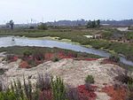
Confluence of Coyote Creek and San Gabriel River, Long Beach, California, on Approach to Long Beach Airport (6013277245) crop

The San Gabriel River is a mostly urban waterway flowing 58 miles (93 km) southward through Los Angeles and Orange Counties, California in the United States. It is the central of three major rivers draining the Greater Los Angeles Area, the others being the Los Angeles River and Santa Ana River. The river's watershed stretches from the rugged San Gabriel Mountains to the heavily developed San Gabriel Valley and a significant part of the Los Angeles coastal plain, emptying into the Pacific Ocean between the cities of Long Beach and Seal Beach. The San Gabriel once ran across a vast alluvial flood plain, its channels shifting with winter floods and forming extensive wetlands along its perennial course, a relatively scarce source of fresh water in this arid region. The Tongva and their ancestors inhabited the San Gabriel River basin for thousands of years at villages like Puvunga, relying on the abundant fish and game in riparian habitats. The river is named for the nearby Mission San Gabriel Arcángel, established in 1771 during the Spanish colonization of California. Its water was heavily used for irrigation and ranching by Spanish, Mexican and American settlers before urbanization began in the early 1900s, eventually transforming much of the watershed into industrial and suburban areas of greater Los Angeles. Severe floods in 1914, 1934 and 1938 spurred Los Angeles County, and later the federal government to build a system of dams and debris basins, and to channelize much of the lower San Gabriel River with riprap or concrete banks. There is also an extensive system of spreading grounds and other works to capture stormwater runoff and conserve it for urban use. Approximately one-third of the water utilized in southeast Los Angeles County today comes from the river. The upper San Gabriel has been intermittently mined for gold since the 1860s, and its deep gravel bed has been an important source of construction aggregate since the early 1900s. The river is also a popular recreation area, with parks and trails in the many flood basins along its course. The headwaters of the San Gabriel River have retained their natural character and are a popular attraction of the Angeles National Forest.

Excerpt from the Wikipedia article San Gabriel River (California) (License: CC BY-SA 3.0, Authors, Images).

San Gabriel River (California)
1st Street,

Geographical coordinates (GPS) Address Phone number Website Nearby Places
placeShow on map

Wikipedia: San Gabriel River (California)Continue reading on Wikipedia

Geographical coordinates (GPS)

Latitude Longitude
N 33.7425 ° E -118.11555555556 °
placeShow on map

Address

The Beach House - Seal Beach

1st Street 15
90740
California, United States
mapOpen on Google Maps

Phone number

call+15622405444

Website
beachhousesb.com

linkVisit website

Confluence of Coyote Creek and San Gabriel River, Long Beach, California, on Approach to Long Beach Airport (6013277245) crop
Share experience

Nearby Places

Marina Pacifica

Marina Pacifica is a marina-adjacent shopping mall featuring movie theaters, shopping, dining & copious parking. It is in southeastern Long Beach, California between Second Street and the Los Cerritos Channel. The shopping center has variously been named Marina Pacifica Mall and Marina Pacifica Shopping Center. Original construction of the shopping center in 1972-3 was a $10 million project of the Robert Tebbe and Southern California Financial corporations on 143 acres of land, an old oil tank farm and several capped oil wells, providing 250,000 square feet (23,000 m2) of gross leasable area for retail, a cinema and offices, oriented to the adjacent marina. The concept was one of a "Mediterranean spa", and peach, oleander and other trees were planted. There was a bridge to an adjacent residential complex.Long Beach-based Buffums department store moved in as an anchor in 1976, building a two-story, 39,000-square-foot (3,600 m2) store designed by Associated Architects and Planners of Los Angeles, and moving its Marina branch from a smaller adjacent 17,000-square-foot (1,600 m2) location. At the time, the new Buffum's formed part of a 108-store, six-restaurant center.A 21,000-square-foot AMC Theatres multicinema was added in 1984.By 1990, the Los Angeles Times characterized Marina Pacifica as an example of "the wrong way to build a mall", a "graveyard", with the staircases too hard to find, lack of a way between shops without traversing the parking lot, vacant storefronts, and a lack of attention. At the time, it was envisioned that Triple Five Joshi Development Co., partner of the Triple Five conglomerate that built the West Edmonton Mall, the world's largest at the time, would buy the Marina Pacifica Mall.Buffum's closed all its branches including Marina Pacifica in 1990. In May 2020 it was announced Pier 1 would close all locations, including the Marinia Pacifica location. It was closed by August 2020. Tower Records closed in 2007 and was replaced by Best Buy in 2008, which closed in October 2018. Club Studio, a new concept of luxury gym run by LA Fitness, has opened in this location since September 2023. Current tenants include Nordstrom Rack, AMC Theatres, Barnes & Noble, Sit 'n Sleep, Acapulco, Buffalo Wild Wings, Chipotle, Starbucks, Ulta Beauty, Club Studio, and a Ralphs supermarket.