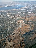
West Menlo Park, California

West Menlo Park is a census-designated place and an Unincorporated community in San Mateo County, California, located between the majority of City of Menlo Park, the Town of Atherton, the Sharon Heights neighborhood of Menlo Park and Stanford University (in Santa Clara County). As of the 2020 census, the community had a population of 3,930. The area consists of suburban housing and a small business district along Alameda de las Pulgas (literally, "Avenue of the Fleas"), often just referred to as "the Alameda", which extends the length of the Rancho de las Pulgas land granted to the Argüello family. West Menlo Park is served by the Las Lomitas School District and Menlo Park Fire District.
Excerpt from the Wikipedia article West Menlo Park, California (License: CC BY-SA 3.0, Authors, Images).West Menlo Park, California
Oakley Avenue,
Geographical coordinates (GPS) Address Nearby Places Show on map
Geographical coordinates (GPS)
| Latitude | Longitude |
|---|---|
| N 37.433611111111 ° | E -122.20305555556 ° |
Address
Oakley Avenue
94027
California, United States
Open on Google Maps


