Beit Horon
1977 establishments in the Israeli Military GovernorateCommunity settlementsIsraeli settlements in the West BankMateh Binyamin Regional CouncilMixed Israeli settlements ... and 1 more
Populated places established in 1977

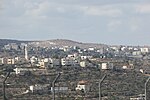
Beit Horon (Hebrew: בֵּית חוֹרוֹן) is a communal Israeli settlement in the West Bank. Bordering Route 443 between Modi'in and Jerusalem, the biblical pass of Beit Horon (Joshua 10:10), after which it is named, it falls under the jurisdiction of Mateh Binyamin Regional Council. In 2021 it had a population of 1,468. The international community considers Israeli settlements in the West Bank illegal under international law, but the Israeli government disputes this.
Excerpt from the Wikipedia article Beit Horon (License: CC BY-SA 3.0, Authors, Images).Beit Horon
דרך אוהד,
Geographical coordinates (GPS) Address Nearby Places Show on map
Geographical coordinates (GPS)
| Latitude | Longitude |
|---|---|
| N 31.876666666667 ° | E 35.128611111111 ° |
Address
דרך אוהד
Judea and Samaria, Palestinian Territories
Open on Google Maps


