place

Hayward, California

1876 establishments in CaliforniaCities in Alameda County, CaliforniaCities in the San Francisco Bay AreaHayward, CaliforniaIncorporated cities and towns in California
Japanese-American culture in CaliforniaPopulated coastal places in CaliforniaPopulated places established in 1876Use mdy dates from October 2017
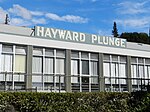
Hayward City Hall number 3 front

Hayward () is a city located in Alameda County, California in the East Bay subregion of the San Francisco Bay Area. With a population of 162,954 as of 2020, Hayward is the sixth largest city in the Bay Area and the third largest in Alameda County. Hayward was ranked as the 34th most populous municipality in California. It is included in the San Francisco–Oakland–San Jose Metropolitan Statistical Area by the US Census. It is located primarily between Castro Valley, San Leandro and Union City, and lies at the eastern terminus of the San Mateo–Hayward Bridge. The city was devastated early in its history by the 1868 Hayward earthquake. From the early 20th century until the beginning of the 1980s, Hayward's economy was dominated by its now defunct food canning and salt production industries.

Excerpt from the Wikipedia article Hayward, California (License: CC BY-SA 3.0, Authors, Images).

Hayward, California
Mission Boulevard, Hayward

Geographical coordinates (GPS) Address Nearby Places
placeShow on map

Wikipedia: Hayward, CaliforniaContinue reading on Wikipedia

Geographical coordinates (GPS)

Latitude Longitude
N 37.66882 ° E -122.080796 °
placeShow on map

Address

Mission Boulevard

Mission Boulevard
94541 Hayward
California, United States
mapOpen on Google Maps

Hayward City Hall number 3 front
Share experience

Nearby Places

Downtown Hayward
Downtown Hayward

Downtown Hayward is the original and current central business district of Hayward, California, United States, and is home to the current Hayward City Hall, along with the two previous city halls, Alex Giualini Plaza and the City Center Building. The Hayward Fault runs through the area, and is the cause of the two previous city halls being taken out of use. The boundaries are Third Street to the east, Grand Street and Hayward BART to the west, Jackson Street and E Street to the south, and City Center Drive/Hazel Avenue to the north. Foothill Boulevard was known as "The Golden Strip", a retail business corridor that was built in the 1950s, and housed Capwell's and I. Magnin department stores. The street lost businesses after the opening of Southland Mall in 1964. Parks include Newman Park and The Julio Bras Portuguese Park. San Lorenzo Creek runs through downtown. The Hayward Public Library is located there. "Hayward City Center" a mall and building complex located at the northern end of downtown, contains the City Center Building, which served as the city's second city hall from 1969 to 1991, and is now an abandoned 11 story building, Hayward's tallest building, formerly the second tallest prior to California State University, East Bay's Warren Hall demolition in 2013. The City Center complex previously contained the now demolished Centennial Hall Convention Center. The bankrupt Mervyns department store chain's large former headquarters is across the street from the City Center mall. The Hayward Area Historical Society operates a museum downtown, which relocated and re-opened June 2014. The FBI operates a resident agency in downtown Hayward. The Hayward Art Council, founded in 1975, operates the Sun Gallery downtown. The Independent Order of Odd Fellows building on B Street is one of Hayward's oldest buildings, and was built in 1868. The Hayward 9/11 Memorial was dedicated May 30, 2016, to the first responders who died in 9/11, and to the city's own fallen first responders, and the city's fallen soldiers.