place

Chaplin Estates

Neighbourhoods in TorontoUse Canadian English from January 2023
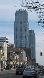
Lascalles Avenue Chaplin Estates

Chaplin Estates is a neighbourhood that covers the southwest portion of the Yonge and Eglinton area in Toronto, Ontario, Canada. It lies west of Yonge Street and is bounded by Eglinton Avenue to the north and Avenue Road to the west. The southern boundary is Chaplin Crescent, which runs parallel to the former Beltline Railway line, now the Beltline Trail, a scenic walking and biking trail. A portion of the Toronto Transit Commission's Yonge-University-Spadina subway line runs above ground along the eastern fringe of Chaplin Estates, and transit access is provided through Davisville station and Eglinton station. Chaplin Estates is one of the wealthiest neighbourhoods in Toronto.

Excerpt from the Wikipedia article Chaplin Estates (License: CC BY-SA 3.0, Authors, Images).

Chaplin Estates
Colin Avenue, Old Toronto

Geographical coordinates (GPS) Address Nearby Places
placeShow on map

Wikipedia: Chaplin EstatesContinue reading on Wikipedia

Geographical coordinates (GPS)

Latitude Longitude
N 43.7 ° E -79.4 °
placeShow on map

Address

Colin Avenue 41
M5P 1A3 Old Toronto
Ontario, Canada
mapOpen on Google Maps

Lascalles Avenue Chaplin Estates
Share experience

Nearby Places

William McBrien Building

William McBrien Building (formally known as the W. C. McBrien Building) is the administrative headquarters of the Toronto Transit Commission. Designed by Charles B. Dolphin (1888-1969) and opened on February 7, 1958, the seven-storey building is located at 1900 Yonge Street above the Davisville subway station. The building is named for former TTC Chairman William C. McBrien who died in June 1954, shortly after the opening of the Yonge Subway. The TTC's Customer Service Centre is located on the ground floor of the building.The building is 28 metres (92 ft) wide, 50 metres (163 ft) long and contains 11,000 square metres (120,000 sq ft) of floor space. Its exterior is made of limestone quarried at Queenston, Ontario. The main-floor lobby is lined with light brown Italian marble. The building incorporates an entrance to Davisville subway station located below street level as well as bus bays at ground level. The building design allows for expansion from its current seven storeys to ten storeys.Prior to the opening of the McBrien Building, the TTC head office was in the old Toronto Board of Trade Building (built 1890 and demolished 1958) located at the north-east corner of Yonge and Front streets. This was the TTC's first permanent home since April 1922. The TTC outgrew the old building with its limited floor space, and starting in 1928, the TTC had to acquire space elsewhere. Starting in 1953, functions such as purchasing, safety, research, engineering, among others were moved to the J.G. Inglis Building at the Hillcrest Complex. In 1958, the executive, legal and treasury functions moved to the McBrien Building.

Eglinton, Ontario
Eglinton, Ontario

Eglinton was a small farming village located at what is today the intersection of Yonge Street and Eglinton Avenue in York County, Ontario, Canada. It was first settled in the early 19th century and became the agricultural hub for the area just north of the city of Toronto. During the early 19th century, the area was part of the largest cattle-grazing region in Upper Canada (now the southern region of Ontario). The region was the first in North America to extend the use of cowbells to all cattle in a herd. Prior to this, it had been standard practice for a cowbell to be attached only to the best and leading animal in a group of livestock. To honour this proud and storied heritage, the City of Toronto named a local street Cowbell Lane.The village was also an important stop on Yonge Street, the main road north from Toronto. One of the first settlers was John Montgomery, who founded a tavern catering to travelers. He likely named the village after the Earls of Eglinton, who had the family name Montgomerie and with whom he believed he had some connection. The name of the village would later be given to the east–west trail running through it, which would become Eglinton Avenue. In 1837 Montgomery's Tavern served as the base of William Lyon Mackenzie's rebels and was the site of the Battle of Montgomery's Tavern. A successful village of 700 people, the area's character changed in 1884 when the Metropolitan Street Railway began running a horse-drawn streetcar up Yonge Street to the village. Rapid housing development soon followed. As the population grew, the settlement was in 1890 incorporated with the smaller Davisville Village into the town of North Toronto. North Toronto was annexed to Toronto two decades later. Both Eglinton Avenue and Eglinton station (on Lines 1 and 5 of the Toronto subway system) are ultimately named after the village.