Auraria, Denver
1858 establishments in Kansas TerritoryColorado Mining BoomFormer colonial and territorial capitals in the United StatesHistory of DenverNeighborhoods in Denver ... and 1 more
Populated places established in 1858

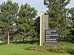
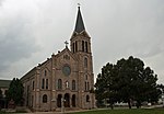
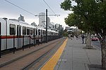
Auraria was a small mining settlement in the Kansas Territory in the United States. Today it survives in its original location as a neighborhood of Denver, Colorado, south of the confluence of Cherry Creek and the South Platte River.
Excerpt from the Wikipedia article Auraria, Denver (License: CC BY-SA 3.0, Authors, Images).Auraria, Denver
Lawrence Way, Denver
Geographical coordinates (GPS) Address Nearby Places Show on map
Geographical coordinates (GPS)
| Latitude | Longitude |
|---|---|
| N 39.743055555556 ° | E -105.00555555556 ° |
Address
King Center
Lawrence Way 777
80204 Denver
Colorado, United States
Open on Google Maps


