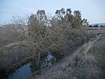
Shadow Cliffs Regional Recreation Area
1971 establishments in CaliforniaEast Bay Regional Park DistrictGeography of Pleasanton, CaliforniaLivermore, CaliforniaLivermore Valley ... and 2 more
Parks in Alameda County, CaliforniaProtected areas established in 1971
Shadow Cliffs Regional Recreation Area is a regional park on the border of Pleasanton and Livermore, California, that is part of the East Bay Regional Parks (EBRP) system. Its lake, once a gravel pit, has a sandy beach and is used for swimming, fishing, and recreational boating. The park once featured water slides, which were closed in 2011 and have since been taken down, and are planned to be replaced by an Interpretive Center. The park is also a popular picnic ground.
Excerpt from the Wikipedia article Shadow Cliffs Regional Recreation Area (License: CC BY-SA 3.0, Authors).Shadow Cliffs Regional Recreation Area
North Arroyo Trail,
Geographical coordinates (GPS) Address Nearby Places Show on map
Geographical coordinates (GPS)
| Latitude | Longitude |
|---|---|
| N 37.669444444444 ° | E -121.83944444444 ° |
Address
North Arroyo Trail
94566
California, United States
Open on Google Maps


