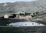
Ohlone Wilderness
Alameda County, California geography stubsEast Bay Regional Park DistrictParks in Alameda County, California

Ohlone Wilderness is a 9,737 acres (39.40 km2) regional park in the United States that is part of the East Bay Regional Parks (EBRPD) system. It is located in southern Alameda County, near the cities of Fremont, California and Sunol, California. It is located between Mission Peak (to its west) and Sunol Regional Wilderness (to its east).
Excerpt from the Wikipedia article Ohlone Wilderness (License: CC BY-SA 3.0, Authors, Images).Ohlone Wilderness
Mission Peak to Monument Peak Trail,
Geographical coordinates (GPS) Address Nearby Places Show on map
Geographical coordinates (GPS)
| Latitude | Longitude |
|---|---|
| N 37.509044444444 ° | E -121.86738888889 ° |
Address
Mission Peak to Monument Peak Trail (Bay Area Ridge Trail)
Mission Peak to Monument Peak Trail
California, United States
Open on Google Maps


