Ladybrook Valley
Areas of Greater ManchesterCheshire geography stubsGeography of the Metropolitan Borough of StockportGreater Manchester geography stubs

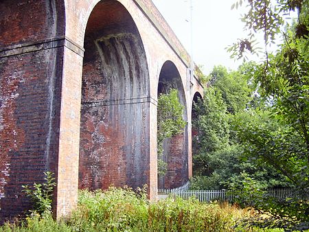
The Ladybrook Valley begins in the English Peak District and runs through Stockport. In its 15 kilometres (9.3 mi) course the brook falls 275 metres (902 ft). At various points it is called Bollinhurst Brook, Norbury Brook, Bramhall Brook, the Ladybrook and the Mickerbrook. The valley has some notable features along its course including Bramall Park and the seven arches railway viaduct in Cheadle Hulme. South of Hazel Grove it is used to delineate the boundary between Greater Manchester and Cheshire. The Ladybrook is a tributary of the River Mersey, the confluence being near to Cheadle Village, immediately after flowing under the M60 motorway.
Excerpt from the Wikipedia article Ladybrook Valley (License: CC BY-SA 3.0, Authors, Images).Ladybrook Valley
Morningside Drive, Manchester
Geographical coordinates (GPS) Address Nearby Places Show on map
Geographical coordinates (GPS)
| Latitude | Longitude |
|---|---|
| N 53.401 ° | E -2.222 ° |
Address
Morningside Drive
M20 5NT Manchester
England, United Kingdom
Open on Google Maps


