place

Ratcliffe College

1845 establishments in EnglandBoarding schools in LeicestershireCatholic boarding schools in EnglandCricket grounds in LeicestershireEducational institutions established in 1845
Member schools of the Headmasters' and Headmistresses' ConferencePeople educated at Ratcliffe CollegePrivate schools in LeicestershireRoman Catholic private schools in the Diocese of NottinghamSports venues completed in 1948Use British English from February 2023
Coat of Arms of Ratcliffe College

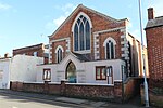
Ratcliffe College is a coeducational Catholic private boarding and day school near the village of Ratcliffe on the Wreake, Leicestershire, approximately 7 miles (11 km) from Leicester, England. The college, situated in 100 acres (0.40 km2) of parkland on the Fosse Way about six miles (10 km) north of Leicester, was founded on the instructions of Blessed Father Antonio Rosmini-Serbati in 1845 as a seminary. In 1847, the buildings were converted for use as a boarding school for upper-class boys. The college became coeducational under the presidency of Father Tony Baxter in the mid-1970s. As of the 2018–2019 academic years, there were 850 students on roll at Ratcliffe, from ages 3 to 18.The school buildings were designed by the Victorian Gothic revivalist Augustus Welby Pugin. Pugin, who is associated with Catholic architecture throughout the Midlands and north of England, is also noted for his collaboration with Charles Barry in the reconstruction of the Palace of Westminster. The Square was designed by Charles Francis Hansom, brother of Joseph Hansom, the designer of the Hansom cab. Various building works over the years have contributed to Pugin and Hansom's work, and modern buildings include a "new" gothic refectory (constructed in the early years of the twentieth century) and a Byzantine-style church.

Excerpt from the Wikipedia article Ratcliffe College (License: CC BY-SA 3.0, Authors, Images).

Ratcliffe College
A46, Charnwood Ratcliffe on the Wreake

Geographical coordinates (GPS) Address Phone number Website External links Nearby Places
placeShow on map

Wikipedia: Ratcliffe CollegeContinue reading on Wikipedia

Geographical coordinates (GPS)

Latitude Longitude
N 52.7294 ° E -1.0758 °
placeShow on map

Address

Ratcliffe College

A46 351
LE7 4SG Charnwood, Ratcliffe on the Wreake
England, United Kingdom
mapOpen on Google Maps

Phone number

call+441509817000

Website
ratcliffecollege.com

linkVisit website

linkWikiData (Q7295515)
linkOpenStreetMap (391204273)

Coat of Arms of Ratcliffe College
Share experience

Nearby Places

Ratcliffe on the Wreake

Ratcliffe on the Wreake is a village and civil parish in the Charnwood district of Leicestershire, England. The population of the civil parish at the 2011 census was 179. It is just to the north of the River Wreake, opposite East Goscote. The village is small enough not to have a parish council; instead it has a parish meeting consisting of all the electorate. The 14th-century St Botolph parish church is a Grade II* listed building.Ratcliffe Hall is a Grade II listed country house built c. 1812 by Robert Shirley, 7th Earl Ferrers and was inherited by his granddaughter, Caroline Shirley, Duchess Sforza Cesarini, who had married into the Italian aristocracy. It subsequently descended to the pioneer aviator, Sir William Lindsay Everard, who set up Ratcliffe Aerodrome, which opened with a 'Grand Air Pageant' on 6 September 1930. Famed aviator Amy Johnson made an unexpected trip from London to participate with Sir Sefton Brancker, Director of Civil Aviation. Some 5,000 spectators were treated to a show with 100 planes and staged bombings of Chinese pirates. There was one crash, but no one was killed. Ratcliffe Aerodrome was one of the finest in civil aviation with a comfortable clubhouse and an outdoor pool. The hangars were first class and the many air shows and displays had the atmosphere of a garden party.Ratcliffe is known for its abundance in wildlife especially crayfish which inhabit the River Wreake right through the village.

East Goscote
East Goscote

East Goscote is a modern village and civil parish in the Borough of Charnwood district of Leicestershire, England, just north of the market town of Syston. It is a medium-sized village, with a population measured at 2,866 in the 2011 census. The village is twinned with Fleury-sur-Andelle, France. The village's name either derives from the Old English gos-cot meaning 'cottages where geese are kept', or from an Anglo-Saxon named Gosa.The name is taken from the East Goscote Hundred, one of the old hundreds (an area of land purported to be able to support 100 families) of Leicestershire. The Goscote Hundred (or Wapentake) is mentioned in the Domesday Book, this was later split into the West and East Goscote Hundreds. It was the first new village to be created in Leicestershire since Domesday. The village is built on the site of a former British Army supply depot. According to Ministry of Defence (MoD) files, the site was originally constructed in 1940 (finished September 1942) by Holloway Brothers, and was an Agency Filling Factory run by Lever Brothers/Unilever as No.10 Royal Ordnance Factory (10 ROF). At that time, it was known as the Queniborough Depot, since that was the closest village to it. It began production in March/April 1942. The aerial photograph reveals its former road layout. According to English Heritage's reference work Dangerous Energy, it was operating Groups 8-10 of ROF filling types (High Explosives received, mixed, and put into bombs and warheads). By 1944, it was temporarily occupied by the War Office. A report of 1951 has it designated as 78 COSD (Command Ordnance Sub Depot). It was decommissioned in 1959, and subsequently bought for housing development by Jelson Homes. This development began in 1962. There were two enormous shell storage bunkers that could not be demolished, and these were earthed over and landscaped. They became known locally as the 'Mound', and are now part of the adjacent playing fields. These were opened to the public as part of the Queen's Silver Jubilee celebrations in 1977, and there is a plaque near Long Furrow noting this fact. The road called Long Furrow serves as a perimeter around the central part of the village; it also serves to mark the boundary of the former ordnance site. What is less well known is the huge network of large reinforced concrete tunnels that lay beneath the whole village; where the munitions were fitted with their warheads, and new top secret weapons prototypes were put together. There are several entrances to these workshops and tunnels located throughout the village, but each have been carefully landscaped to conceal their identity. Council representatives did enter these chambers, and found that the tunnels were in excellent condition, and the electricity still worked. Until the mid-1970s, during which the village was still under construction, both entrances to the 'Mound' were open, and often visited by local children. A map of the actual tunnel layout did exist in the Library of Wreake Valley Community College, Syston, but was misplaced to keep the tunnels hidden. The whole structure, and stories that lay beneath its present inhabitants is worthy of a serious study, survey, and television documentary. The first family to move in did so in 1965, even though the village lacked many amenities at the time, including street lighting. The village is served by Broomfield County Primary School, which was opened in 1968. The school was expanded in 1977 to cope with the number of children on the village. The original design made no mention of the village hall, and this was built by Jelson Homes free of charge. It was the home of religious services until the completion of St Hilda's Church in 1976. The first village vicar was the Reverend Dudley Gummer, who took services in his own house in Coopers Nook, until the village hall was built. The village had its own magazine East Goscote Community News, which was first published in 1969. It ceased publication in the mid-1980s, after many issues. Now they have a magazine called Long Furrow. Adjacent to the village, north of the railway line, is Beedles Lake Golf Club. East Goscote ward is represented on Charnwood Borough Council by Green Party Councillor Laurie Needham. Before 2015, it was represented by Cathy Duffy, the only elected representative in the locality from the far-right British National Party (BNP).Charnwood Borough Council has stated that there will be a new railway station to open at East Goscote, on the railway line towards Melton Mowbray.

Cossington, Leicestershire

Cossington is a village within the Soar Valley in Leicestershire, England. It lies between Sileby, Rothley, Ratcliffe-on-the-Wreake and Syston. The population of the civil parish at the 2011 census was 598.The village's name means 'farm/settlement of Cusa/Cosa'.Although there is no railway service to Cossington, the Ivanhoe Line runs along the Midland Main Line between Leicester and Loughborough, passing close to the village. An hourly service is provided in both directions as part of East Midlands Railway Local service from Lincoln to Leicester via Nottingham. Many years ago there was a 'Cossington Gate railway station' which has long since gone, the only evidence remaining on old maps, The nearest stations now being at Syston and Sileby. Cossington was once home to Lady Isobel Barnett, a radio and television personality from the mid 20th century, where she committed suicide amidst shoplifting charges. A short new road, Barnett Close, has been named in her memory. The village is home to three small businesses; two garden centres (Derry's Nursery and Goscote Nursery) and a pub, The Royal Oak In the early 1990s there were plans to expand the village, which were strongly opposed by the residents at the time, who formed the protest group 'Cossington In Distress'. The residents were successful in bringing about the cessation of the work and the village remains a peaceful community to this day. Every alternate Easter the residents of Cossington open their gardens to the public for two days for the 'Secret Gardens of Cossington' in which the village's willing gardeners show off their talents, with all the proceeds of ticket sales going to charity. The event has been a massive success every time it has run. The church of All Saints dates from the 13th century. A ‘Grant of Arms’ of the Fisher family displayed on the tower wall above the arch. There are memorial tablets to the Fisher family of which Geoffrey Fisher became Archbishop of Canterbury in the 1950s.To the south of the village lies Platts Lane Recreation Ground (more simply known as just 'Platts Lane') which is owned by the Platts Lane Charitable Trust and run by a volunteer committee made up of mostly village residents. Platts Lane is basically a large playing field area and plays host to football, cricket and rugby matches - most notably being the home of Sileby Town Rugby Football Club who are also known as 'The Vikings' and play all their home fixtures at Platts Lane, which many locals enjoy watching. Nearby is Ratcliffe College. A notable native of Cossington was John Webster, governor of Connecticut Colony in 1656. John Webster's Great-great-great-grandson Noah Webster Jr Wrote what became the Merriam-Webster Dictionary around 1875 The Australian artist Grace Cossington Smith's mother (also Grace, née Fisher) was the daughter of a rector of Cossington from the Fisher family (see above). To the east of the village there is a footpath named "Polly Peggs Footpath". Local village legend says a distressed girl drowned herself after falling pregnant whilst courting. Her lover, father and even the church abandoned her and she committed suicide.