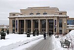
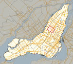
Saint-Michel, Montreal
Former municipalities in QuebecMontreal geography stubsNeighbourhoods in MontrealQuebec road stubsStreets in Montreal ... and 1 more
Villeray–Saint-Michel–Parc-Extension
Saint-Michel is a neighbourhood in the Montreal borough of Villeray–Saint-Michel–Parc-Extension. It is named for a colonial-era road in the neighbourhood. Its boundaries correspond to the former city of Ville Saint Michel, which was annexed to Montreal in 1968. This former independent city was known as Saint-Michel-de-Laval from its inception in 1912 to 1914 and Ville Saint Michel from 1914 to 1968. This was one of the last cities to be merged into Montreal until the 2002 municipal reorganization.
Excerpt from the Wikipedia article Saint-Michel, Montreal (License: CC BY-SA 3.0, Authors).Saint-Michel, Montreal
Boulevard Saint-Michel, Montreal Villeray–Saint-Michel–Parc-Extension
Geographical coordinates (GPS) Address Nearby Places Show on map
Geographical coordinates (GPS)
| Latitude | Longitude |
|---|---|
| N 45.563888888889 ° | E -73.609722222222 ° |
Address
Boulevard Saint-Michel 8115
H1Z 3E3 Montreal, Villeray–Saint-Michel–Parc-Extension
Quebec, Canada
Open on Google Maps


