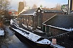
Stoke-on-Trent built-up area
Potteries Urban AreaStaffordshire geography stubsUrban areas of England

The Stoke-on-Trent Built-up Area or The Potteries Urban Area or colloquially, simply "The Potteries" is a conurbation in North Staffordshire in the West Midlands region of England. It includes the City of Stoke-on-Trent, and parts of the boroughs of Newcastle-under-Lyme and Staffordshire Moorlands.The area had a population of 384,000 in 2019, a small increase from the 2001 census figure of 362,403 with Stoke-on-Trent making up over 70% of this population. It is sometimes called The Potteries Urban Area due to the area's fame for pottery manufacture ever since the industrial revolution.
Excerpt from the Wikipedia article Stoke-on-Trent built-up area (License: CC BY-SA 3.0, Authors, Images).Stoke-on-Trent built-up area
Etruscan Street, Stoke-on-Trent Etruria
Geographical coordinates (GPS) Address Nearby Places Show on map
Geographical coordinates (GPS)
| Latitude | Longitude |
|---|---|
| N 53.02 ° | E -2.2 ° |
Address
Etruscan Street
Etruscan Street
ST1 5PF Stoke-on-Trent, Etruria
England, United Kingdom
Open on Google Maps


