Tuntenhausen

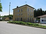
Tuntenhausen is a municipality in the district of Rosenheim in Bavaria in Germany. There are 57 official districts of Tuntenhausen, namely Tuntenhausen itself, Antersberg, Aubenhausen, Bach, Berg, Beyharting, Biberg, Bichl (this Bichl is an Einöde), Bichl (this Bichl is a Weiler (hamlet)), Bolkam, Brettschleipfen, Dettendorf, Eggarten, Eisenbartling, Emling, Fischbach, Fuchsholz, Großrain, Guperding, Haus, Höglhaus, Hohenthann, Holzbichl, Hopfen, Hörmating, Innerthann, Jakobsberg, Karlsried, Knogl, Kronbichl, Lampferding, Mailling, Maxlrain, Moosmühle, Mühlholz, Neureith, Nordhof, Oberrain, Oed, Ostermünchen, Pangraz, Schlafthal, Schmidhausen, Schönau, Schwaig, Schweizerberg, Schweizerting, Seisrain, Sindlhausen, Söhl, Stetten (this Stetten is a Dorf (village)), Stetten (this Stetten is an Einöde), Thal, Unterrain, Voglried, Weiching, Weng.Ostermünchen is a station of the Munich–Rosenheim railway and served about once per hour by local trains.The town is known best for its church, a destination for Roman Catholic pilgrims in Bavaria. The name of the town translates to "sissy town" or "fag town" what makes it sound funny to some German-speakers.
Excerpt from the Wikipedia article Tuntenhausen (License: CC BY-SA 3.0, Authors, Images).Tuntenhausen
Alpenweg,
Geographical coordinates (GPS) Address Nearby Places Show on map
Geographical coordinates (GPS)
| Latitude | Longitude |
|---|---|
| N 47.933333333333 ° | E 12.016666666667 ° |
Address
Alpenweg 20
83104
Bavaria, Germany
Open on Google Maps


