place

Calthorpe Broad

National nature reserves in EnglandNature Conservation Review sitesNorfolk BroadsRamsar sites in EnglandSites of Special Scientific Interest in Norfolk
Special Areas of Conservation in EnglandSpecial Protection Areas in England
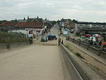
View to Calthorpe Broad geograph.org.uk 578841

Calthorpe Broad is a 43.5-hectare (107-acre) biological Site of Special Scientific Interest east of Stalham in Norfolk. It is a Nature Conservation Review site, Grade I and a national nature reserve. It is also part of the Broadland Ramsar site and Special Protection Area, and The Broads Special Area of Conservation.This broad has diverse fauna and flora. Water plants include mare's-tail, water violet, blunt-leaved pondweed, spiked water-milfoil, floating scirpus, yellow water-lily and the nationally scarce water soldier.The site is private land with no public access.

Excerpt from the Wikipedia article Calthorpe Broad (License: CC BY-SA 3.0, Authors, Images).

Calthorpe Broad
Sea Palling Road, North Norfolk Ingham

Geographical coordinates (GPS) Address Nearby Places
placeShow on map

Wikipedia: Calthorpe BroadContinue reading on Wikipedia

Geographical coordinates (GPS)

Latitude Longitude
N 52.777 ° E 1.573 °
placeShow on map

Address

Sea Palling Road
NR12 0TP North Norfolk, Ingham
England, United Kingdom
mapOpen on Google Maps

View to Calthorpe Broad geograph.org.uk 578841
Share experience

Nearby Places

Hickling, Norfolk
Hickling, Norfolk

Hickling is a village and a civil parish in the English county of Norfolk. The village is 22 miles south-east of Cromer, 20.3 miles north-east of Norwich and 137 miles north-east of London. The village lies 3 miles east of the Broadlands town of Stalham. The nearest railway station is at Worstead for the Bittern Line which runs between Sheringham, Cromer and Norwich. The villages name means 'Hicel's people' or perhaps, 'Hicel's place'. The village comprises two main parts, Hickling Green and Hickling Heath. Hickling Heath is the part which usually attracts the most tourists who come on boat trips and moor up at the staithe. Hickling village is situated on the edge of the Hickling Broads. By using the waterways it is possible to reach Catfield Dyke, Potter Heigham and even Great Yarmouth. Because it leads to the sea the waters are slightly tidal and, depending on the time of year, the water levels can heavily rise or fall. There are many thatched huts dotted along the broads, one of the oldest being Turner's Hut. Hickling Mill, built on Hickling Heath in 1818, is a grade II* listed windmill which is one of the few to have been preserved in almost original condition, with most of the mechanism, apart from sails and fantail, relatively intact.Adjacent to the village is the site of Hickling Priory, a house of Augustinian Canons which operated from 1185 to 1534. The 18th-century Hickling Hall was destroyed by fire in December 2014.

Lambridge Mill
Lambridge Mill

Lambridge Mill also known as Lambrigg Mill is a wind pump located in the parish of Sea Palling within the Norfolk Broads National Park, United Kingdom and can be found at grid reference grid reference TG431252, it is approximately 2 miles southwest of Waxham. The wind pump is a grade II listed building.The current wind pump at this location was built c. 1865 and it fell out of use around 1937. The Mill was built to drain the nearby Long Gore Marsh (located to the south of the mill) along with the Brograve Levels as a helper mill for its much older neighbour Brograve Mill. Both this mill and Brograve Mill drained the levels into the Waxham New Cut via the same drainage channel. The name of the mill is also somewhat disputed, as the current Ordnance Survey Explorer map states the name of the mill as Lambrigg Mill. The name Lambridge, however, corresponds with the names of the nearby Lambridge Mill Farm and Lambridge Mill Cottage. The mill still stands today in a derelict state with only two of the original four stocks remaining, these being precariously perched on top of the brickwork attached to the exposed iron windshaft. Only a small rotten section of the original cap remains. It is difficult to directly reach the mill due to it being located within the private garden of Lambridge Mill Cottage; no public rights of way run nearby. However, it is possible to get relatively close to the structure via the Waxham New Cut, the mill is well beyond the limit of navigation, therefore only small non-motorised craft may venture this far up the river.