Round Mountain (British Columbia)
British Columbia Coast geography stubsGaribaldi Lake volcanic fieldOne-thousanders of British ColumbiaPleistocene British ColumbiaPleistocene volcanoes ... and 2 more
Subduction volcanoesVolcanoes of British Columbia
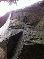
Round Mountain is an eroded volcanic outcrop in the Garibaldi Volcanic Belt in British Columbia, Canada, located 8 km southwest of Eanastick Meadows, 9 km (6 mi) east of Brackendale and 10 km (6 mi) south of Mount Garibaldi. It is the highpoint of Paul Ridge and is located in the southwest corner of Garibaldi Provincial Park. Round Mountain formed as a result of subduction of the Juan de Fuca Plate beneath the North American Plate, known as the Cascadia subduction zone. Round Mountain last erupted during the Pleistocene.
Excerpt from the Wikipedia article Round Mountain (British Columbia) (License: CC BY-SA 3.0, Authors).Round Mountain (British Columbia)
Elfin Lakes Trail, Area D (Elaho/Garibaldi)
Geographical coordinates (GPS) Address Nearby Places Show on map
Geographical coordinates (GPS)
| Latitude | Longitude |
|---|---|
| N 49.764861111111 ° | E -123.02419444444 ° |
Address
Elfin Lakes Trail
Elfin Lakes Trail
Area D (Elaho/Garibaldi)
British Columbia, Canada
Open on Google Maps


