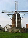
Heer, Maastricht
Former municipalities of Limburg (Netherlands)Limburg (Netherlands) geography stubsNeighbourhoods of Maastricht

Heer is a neighbourhood of Maastricht, in the Dutch province of Limburg. Heer is a former municipality and village, incorporated into Maastricht in 1970 and, until 1828, this municipality was called "Heer en Keer". The municipality covered the former villages of Heer and Scharn. It is located on the right bank of the river Meuse.
Excerpt from the Wikipedia article Heer, Maastricht (License: CC BY-SA 3.0, Authors, Images).Heer, Maastricht
Dorpstraat, Maastricht
Geographical coordinates (GPS) Address Nearby Places Show on map
Geographical coordinates (GPS)
| Latitude | Longitude |
|---|---|
| N 50.840555555556 ° | E 5.7269444444444 ° |
Address
Sint-Petrus Banden
Dorpstraat
6227 BL Maastricht
Limburg, Netherlands
Open on Google Maps


