Inzigkofen
Municipalities in Baden-WürttembergPaleontological sites of EuropeSigmaringen (district)Tübingen region geography stubs

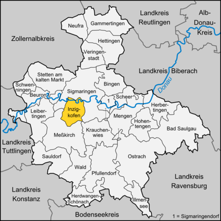
Inzigkofen is a municipality in the district of Sigmaringen in Baden-Württemberg in Germany. Historically, it is part of the Swabian north Alpine foreland basin.It consists of three districts: Within Engelswies is the now-abandoned Talsberg quarry, known for its fossiliferous layers, and the site of evidence of the oldest Eurasian hominoids; a molar tooth found there in June 1973 was reported in June 2011 to have been "dated with relative precision at 17 to 17.1 Ma" (million years ago).
Excerpt from the Wikipedia article Inzigkofen (License: CC BY-SA 3.0, Authors, Images).Inzigkofen
Am Schlossblick, Gemeindeverwaltungsverband Sigmaringen
Geographical coordinates (GPS) Address Nearby Places Show on map
Geographical coordinates (GPS)
| Latitude | Longitude |
|---|---|
| N 48.071666666667 ° | E 9.1755555555556 ° |
Address
Am Schlossblick 6/1
72514 Gemeindeverwaltungsverband Sigmaringen
Baden-Württemberg, Germany
Open on Google Maps


