Duke Point, British Columbia
British Columbia Coast geography stubsNeighbourhoods in Nanaimo

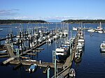
Duke Point is a geographical location in the extreme southeastern part of the city of Nanaimo in British Columbia. It is located on a thin peninsula to the east of the Nanaimo River estuary, just across the Northumberland Channel from Gabriola Island. An industrial park is located at Duke Point, which includes one sawmill. The Duke Point ferry terminal is also located here, but there are no public transit connections.
Excerpt from the Wikipedia article Duke Point, British Columbia (License: CC BY-SA 3.0, Authors, Images).Duke Point, British Columbia
Duke Point Highway, Nanaimo
Geographical coordinates (GPS) Address Phone number Website Nearby Places Show on map
Geographical coordinates (GPS)
| Latitude | Longitude |
|---|---|
| N 49.161389 ° | E -123.891792 ° |
Address
Duke Point ferry terminal (Nanaimo (Duke Point) ferry terminal)
Duke Point Highway 400
V9X 1H6 Nanaimo
British Columbia, Canada
Open on Google Maps


