Lebanon-Warren County Airport
Airports in OhioBuildings and structures in Warren County, OhioCounty airports in OhioTransportation in Warren County, Ohio

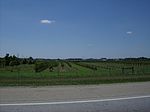
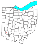
Lebanon-Warren County Airport (FAA LID: I68) is a public airport located three miles (5 km) northwest of the central business district of Lebanon, on Greentree Road, in Warren County, Ohio, United States.It is a county-owned public airport operated by the Warren County Airport Authority, a board of 9 members appointed by the County Commissioners. The runway, taxiway, and communication and navigation aids are County owned. The Airport Authority leases a terminal for public use on adjacent private property. The hangars, and other airport buildings are privately owned and operated. Daily airport management is handled under contract by fixed-base operator (FBO), Warren County Airport, Ltd.
Excerpt from the Wikipedia article Lebanon-Warren County Airport (License: CC BY-SA 3.0, Authors, Images).Lebanon-Warren County Airport
Mabrey Road,
Geographical coordinates (GPS) Address External links Nearby Places Show on map
Geographical coordinates (GPS)
| Latitude | Longitude |
|---|---|
| N 39.462222222222 ° | E -84.251944444444 ° |
Address
Warren County Airport (John Lane Field;Warren County Industrial Air Park)
Mabrey Road
45036
Ohio, United States
Open on Google Maps


