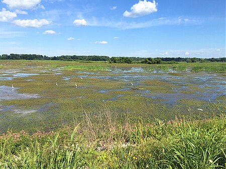
Shiawassee National Wildlife Refuge

The Shiawassee National Wildlife Refuge is a 9,870.35 acres (39.9439 km2) National Wildlife Refuge in Saginaw County managed by the United States Fish and Wildlife Service. It is located in the central portion of the lower peninsula of the U.S. state of Michigan, approximately 25 miles (40 km) south of the Saginaw Bay in Lake Huron and five miles (8 km) south of the city of Saginaw in the county's Spaulding and James townships. It was established in 1953 to provide habitat for migratory waterfowl. Known locally as the Shiawassee Flats, the refuge lies in the Saginaw Bay watershed, historically one of the largest and most productive wetland ecosystems in Michigan. The Bad, Flint, and Cass Rivers flow into the Shiawassee River in the refuge. Here also the Shiawassee converges with the Tittabawassee River to form the Saginaw River.
Excerpt from the Wikipedia article Shiawassee National Wildlife Refuge (License: CC BY-SA 3.0, Authors, Images).Shiawassee National Wildlife Refuge
Driving Tour, Spaulding Township
Geographical coordinates (GPS) Address Nearby Places Show on map
Geographical coordinates (GPS)
| Latitude | Longitude |
|---|---|
| N 43.366666666667 ° | E -84.016666666667 ° |
Address
Driving Tour
Driving Tour
Spaulding Township
Michigan, United States
Open on Google Maps


