Sidney, British Columbia

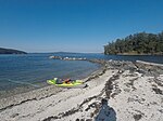
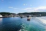
Sidney is a town located at the northern end of the Saanich Peninsula, on Vancouver Island in the province of British Columbia. It's 1 of the 13 Greater Victoria municipalities. It has a population of approximately 11,583. Sidney is located just east of Victoria International Airport, and about 6 km (4 mi) south of BC Ferries' Swartz Bay Terminal. The town is also the only Canadian port-of-call in the Washington State Ferries system, with ferries running from Sidney to the San Juan Islands and Anacortes. Sidney is located along Highway 17, which bisects the town from north to south. It is generally considered part of the Victoria metropolitan area. The town west of Highway 17 (also called Patricia Bay Highway, locally abbreviated as the Pat Bay Highway) has a mixture of single-family residences and light industry. The majority of the town is located east of Highway 17. Single-family units are also present east of the highway, but the eastern sector also has many condominium-type buildings, plus most of the service and retail outlets. The island-studded Haro Strait, part of the Salish Sea, forms Sidney's eastern boundary. There is a large boating and marine industry in the area, ranging from marinas to boatbuilders and marine suppliers. Sidney takes its name from nearby Sidney Island. In 1859, Captain Richards named that island for Frederick W. Sidney, who, like Richards served in the survey branch of the Royal Navy.: 243
Excerpt from the Wikipedia article Sidney, British Columbia (License: CC BY-SA 3.0, Authors, Images).Sidney, British Columbia
Sidney Avenue,
Geographical coordinates (GPS) Address Phone number Website Nearby Places Show on map
Geographical coordinates (GPS)
| Latitude | Longitude |
|---|---|
| N 48.650555555556 ° | E -123.39861111111 ° |
Address
Town of Sidney Municipal Hall
Sidney Avenue 2440
V8L 1Y7
British Columbia, Canada
Open on Google Maps


