Philpstoun
Villages in West Lothian

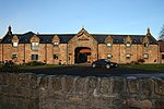
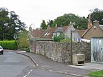
Philpstoun is a small village in West Lothian, Scotland, situated roughly 2 miles (3.2 km) east of the historic county town of Linlithgow. The village originated in the oil shale mining boom of the 19th century. Surrounded by rich arable farm land, the village has a Community Education Centre and a Category B listed church. Philpstoun railway station closed in 1951 and Philpstoun and District Bowling Club closed in February 2012. The bulk of the village lies between the Union Canal and the Glasgow–Edinburgh railway line, although the easternmost part, Old Philpstoun, lies north of the railway and closer to the M9 motorway.
Excerpt from the Wikipedia article Philpstoun (License: CC BY-SA 3.0, Authors, Images).Philpstoun
Cameron Knowe,
Geographical coordinates (GPS) Address Nearby Places Show on map
Geographical coordinates (GPS)
| Latitude | Longitude |
|---|---|
| N 55.97649 ° | E -3.52871 ° |
Address
Cameron Knowe
Cameron Knowe
EH49 6RL
Scotland, United Kingdom
Open on Google Maps
