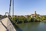
Agout
France river stubsOccitania (administrative region) geography stubsPages with French IPARivers of FranceRivers of Hérault ... and 3 more
Rivers of Occitania (administrative region)Rivers of Tarn (department)Tributaries of the Tarn

The Agout or Agoût (French pronunciation: [aɡu]; Occitan: Agot) is a 194.4-kilometre (120.8 mi) long river in south-western France. It is a left tributary of the Tarn. Its source is in the southern Massif Central, in the Haut-Languedoc Regional Nature Park. It flows generally west through the following department and towns: Hérault: La Salvetat-sur-Agout Tarn: Brassac, Castres, Lavaur, Saint-SulpiceThe Agout flows into the Tarn at Saint-Sulpice. Among its tributaries are the Dadou, the Gijou and the Thoré.
Excerpt from the Wikipedia article Agout (License: CC BY-SA 3.0, Authors, Images).Agout
Chemin du Ga, Albi
Geographical coordinates (GPS) Address Nearby Places Show on map
Geographical coordinates (GPS)
| Latitude | Longitude |
|---|---|
| N 43.784444444444 ° | E 1.6836111111111 ° |
Address
Chemin du Ga
Chemin du Ga
81800 Albi
Occitania, France
Open on Google Maps


