place

Perton, Herefordshire

Herefordshire geography stubsVillages in Herefordshire

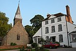
Perton is a hamlet in the English county of Herefordshire. It is in the civil parish of Stoke Edith being west of the village of that name.

Excerpt from the Wikipedia article Perton, Herefordshire (License: CC BY-SA 3.0, Authors).

Perton, Herefordshire
Perton Lane,

Geographical coordinates (GPS) Address Nearby Places
placeShow on map

Wikipedia: Perton, HerefordshireContinue reading on Wikipedia

Geographical coordinates (GPS)

Latitude Longitude
N 52.0614 ° E -2.58923 °
placeShow on map

Address

Perton Lane

Perton Lane
HR1 4HW
England, United Kingdom
mapOpen on Google Maps

Share experience

Nearby Places

Yarkhill
Yarkhill

Yarkhill is a village in Herefordshire, England located about 9 miles (14 km) from both Hereford and Ledbury. The village is Anglo-Saxon in origin and is a much dispersed parish, with no definable nucleus, of approximately 145 homes spread over some 8 square miles (21 km2), comprising about 300 people. It borders the villages of Ashperton, Stoke Edith, Stretton Grandison, Tarrington and Weston Beggard. Yarkhill lies in the valley of the River Frome; in 811 the name of this settlement was Geardcylle, meaning enclosure with a kiln. In 1066 it was held by a Knight of King Harold called Arkell and the present name of Yarkhill may have derived from that or from the Saxon word Yarcle meaning slope of the hill. The sister churches of Tarrington and Stoke Edith can be seen on the other side of the valley. Yarkhill was mentioned in the Domesday Book of 1087 and has been a farming community around the River Frome since that time. Yarkhill once had a school but that has been converted into a village hall. Yarkhill Church is the oldest intact building in the village. Close to the river but high enough to be safe from flooding, it dates from circa 1200 with many extensions, alterations and repairs. St John the Baptist Church is a grade two-listed building. The church is typical in design with a nave, chancel, vestry, and western tower and seats about 120 people at full capacity. In the churchyard there is an ancient and very large yew tree and a war memorial. Yarkhill Church is important to campanologists as the "Father of Change Ringing" Fabian Stedman was born in the village and baptised at St John's church on 7 December 1640. Fabian's father Francis Stedman was Rector of Yarkhill from 1625 to 1671. Francis's time as Rector saw the installation of the current ring of four bells seen today. In October 2012 the Church finally completed the project to install 8 new bells dedicated to the legacy of Fabian Stedman. In fact the new tenor bell of the ring of eight was inscribed "Given by the Bell Restoration Fund who named me Fabian Stedman 1640-1713". The old four bells have been preserved as they hang in the old 17th century bell frame. It is still hoped when funds become available that the old bells will be fitted with chiming apperatur so they can be heard. The new bells have been rung regularly on practice nights and for Sunday service. Many visitors have been given permission to ring the bells for pure enjoyment, and Stedman Triples is a regular method to be heard ringing out from the tower.

River Frome, Herefordshire

The River Frome is a river in Herefordshire, England. It flows through Bromyard, and Bishops Frome. Immediately below the depopulated village of Stretton Grandison its tributary, the river or brook named the Lodon, joins it. It then flows west, past Yarkhill and the farmstead or locality of Prior's Frome before its confluence with the Lugg (which skirts the north side of Hereford here) at Hampton Bishop about 2 miles (3.2 km) before the latter joins the Wye. The valley lies in the Old Red Sandstone formations of this part of Herefordshire, revealing much evidence of the region's geological past. It has left many exposures of Devonian and late Silurian sandstones and mudstones, and has created a landscape that demonstrates the effects of successive phases of glaciofluvial erosion. The river source is on the Bromyard plateau where it cuts through rocks of the St. Maughan's Formation. At the village of Bishop's Frome, the Bishop's Frome Limestone marks the transition to the older, Silurian Raglan Mudstone Formation and enters a broad, low-lying area, where the effects of both the Anglian and Devensian glacial stages can be seen in the rocks and landscape.The river gives its name to hamlets on the high ground to the east: Halmond's Frome, Fromes Hill and Castle Frome. In 2007, like many other rivers in England, the Frome burst its banks. This occurred at places including lower parts of Bromyard, causing homes to be evacuated. A smaller scale recurrence occurred in April and July 2012.