place

Whitfield, Dundee

Areas of DundeeTayside geography stubsUse British English from March 2017

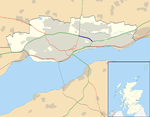
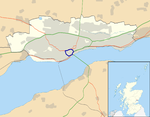
Whitfield is a residential, social-housing scheme located to the north of Dundee, Scotland. Building of scheme commenced in the 1960s to accommodate Dundee's expanding population. Much of the housing was low rise, deck access flats, innovative for the time, built using the "Skarne" prefabrication system. The construction of the northernmost parts of the scheme, which were almost-exclusively Skarne blocks, continued into the early 1970s. Between 1989 and 1995 it was one of the four areas chosen for the Scottish Office programme New Life for Urban Scotland. Much of the deck access housing in the area was demolished as the area was remodelled. In the 2004 Scottish Index of Multiple Deprivation, Whitfield contained two datazones (average population 1,000) in the most deprived 15% of datazones in Scotland. Whitfield had two high rise tower blocks of flats, both constructed in 1969. In 2003 the tower block housing Quarryfield and Whitfield courts was demolished, and in 2004 the neighbouring tower block which housed Greenfield and Kellyfield courts followed. As of 2006 the area is undergoing redevelopment as part of a redevelopment plan and the area is seeing a rise in population.

Excerpt from the Wikipedia article Whitfield, Dundee (License: CC BY-SA 3.0, Authors).

Whitfield, Dundee
Whitfield Drive, Dundee Whitfield

Geographical coordinates (GPS) Address Nearby Places
placeShow on map

Wikipedia: Whitfield, DundeeContinue reading on Wikipedia

Geographical coordinates (GPS)

Latitude Longitude
N 56.488342 ° E -2.925606 °
placeShow on map

Address

Whitfield Drive

Whitfield Drive
DD4 0DP Dundee, Whitfield
Scotland, United Kingdom
mapOpen on Google Maps

Share experience

Nearby Places

Pitkerro

Pitkerro is an area in the eastern part of Dundee, Scotland, immediately west of Douglas and south of Fintry and Whitfield. Areas of Pitkerro include Kingsway East, Linlathen, Mid Craigie, Milton of Craigie and Drumgieth. Pitkerro House was remodelled and relandscaped by Robert Lorimer in 1902.Pitkerro once had four schools, three primary and one secondary. The oldest, St Saviour's RC High School, closed in June 2008 due to decreasing pupil numbers and merged with Lawside Academy at the start of the 2008/9 school year to form St. Paul's Academy. Mosgiel Primary School and Mid Craigie Primary School merged at the start of the 2009/10 year to form Rowantree Primary School, a purpose-built school constructed in 2008. Pitkerro's other school, St. Vincent's RC Primary School was amalgamated with St Luke's & St Matthew's RC Primary School in 2018 to form St. Francis RC Primary School and is now located in the new North East Campus building on Lothian Crescent along with Longhaugh Primary School and Quarryview Nursery. Together, Pitkerro, Kirkton and Hilltown contain 31% of Dundee's enumeration districts which fall within the worst 10% of deprived districts in Scotland.In 1998, a Mecca Bingo hall opened in the Douglasfield area of Pitkerro with an Odeon Cinema opening two years later. Pitkerro has two major Supermarkets, Morrisons in Linlathen, and a 24-hour Asda in Milton of Craigie. The area is served by Dundee bus routes 15a, 15c and 17 operated by Xplore Dundee and 360 operated by Moffat & Williamson.

Fintry, Dundee
Fintry, Dundee

Fintry is a housing scheme in Dundee, Scotland. Fintry is located in the north of the city with Mill o' Mains to the west and Whitfield to the east. On the north, Fintry is bordered by farmland, including the Powrie Farm and Powrie Castle (from which one of the pubs in the area derives its name). Local parks include Powrie Park (at the north of the scheme) and Finlathen Park (in a deep valley to the south of the scheme, through which runs the Dighty Burn). Fintry had a population of 6592 in 2011.Customarily, the borders of the scheme are accepted as being: Forfar Road on the west side with Mill O'Mains, Longhaugh Road on the east side with Whitfield and the Dighty Burn on the southern side (inside Finlathen Park). On three of the four sides, and (formerly) half of the north side (see section on Cheviot Crescent and Grampian Gardens), Fintry's borders are defined by three to four storey high tenement blocks. Fintry is in the North East ward of Dundee City Council, represented since May 2012 by Councillors Steven Rome and Willie Sawers of the Scottish National Party, and Councillor Gregor Murray, who is an Independent. Fintry has two bars, the Powrie Bar at Cheviot Crescent and the Dolphin on Fintry Road. Fintry also has two chip shops, two Chinese takeaways known as the Blue Lagoon and Friendlies, and three Indian takeaways, often referred to as the Tartan Tandoori, Mazaydar and the Red Chilli. There are two churches, Fintry Parish Church of scotland and Our Lady of Sorrows Roman Catholic Church. The 22nd Dundee Scouts operates from a hall in the grounds of Fintry Parish Church, and there is also a Girls' Brigade company in the church itself. Mains of Fintry Pipe Band was formed in Fintry in 1972, by Pipe Major William Smith. Other facilities in the community include the Finmill Community Centre on Findcastle Street, and the Library also on Findcastle Street. Fintry is served by three Primary Schools: Fintry Primary (non-denominational, on Findcastle Terrace) and Longhaugh Primary (non-denominational) and St Francis (Catholic school), the latter two both part of the North East campus, opened in 2018, on Lothian Crescent. Fintry is in the catchment area for Braeview Academy Secondary School (non-denominational) and St. Paul's R.C. Academy (Catholic school). There is a Nursery School on the same site as Fintry Primary, and Quarry View nursery is part of the new North East campus on Lothian Crescent. The new Fintry Primary school was completed in around 2010, funded as a Public–private partnership, replacing a "temporary" building originally erected in the 1950s.