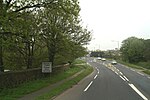
St Erth

St Erth (Cornish: Lannudhno) is a civil parish and village in Cornwall, England. St Erth takes its name from Saint Erc, one of the many Irish saints who brought Christianity to Cornwall during the Dark Ages, and is at the old crossing point of the River Hayle. The Cornish name of the place derives from St Uthinoch of whom little is known. The church of St Erth dates from the 15th-century, though an older church is said to have once stood on St Erth Hill overlooking the village. The St Erth railway station is 0.75 miles from the village, at Rose-an-Grouse, and is on the Cornish Main Line from London Paddington to Penzance. It is also the junction for scenic St Ives Bay Line.
Excerpt from the Wikipedia article St Erth (License: CC BY-SA 3.0, Authors, Images).St Erth
Treloweth Close,
Geographical coordinates (GPS) Address Nearby Places Show on map
Geographical coordinates (GPS)
| Latitude | Longitude |
|---|---|
| N 50.166 ° | E -5.437 ° |
Address
Treloweth Close
Treloweth Close
TR27 6JR , St. Erth
England, United Kingdom
Open on Google Maps


