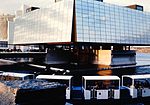
Saint-Lambert, Montérégie

Saint-Lambert (French pronunciation: [sɛ̃ lɑ̃bɛʁ] , locally [sɛ̃ lɑ̃baɛ̯ʁ]) is a city (French: ville) in southwestern Quebec, Canada, located on the south shore of the St. Lawrence River, opposite Montreal. It is part of the Urban agglomeration of Longueuil of the Montérégie administrative region. It was home to 22,745 people according to Thomas Brinkhoff. Saint-Lambert is divided into two main sections: the original city of Saint-Lambert and the Préville neighbourhood. The original city of Saint-Lambert (as it existed prior to 1969) is located from the Country Club of Montreal golf course to the border of the Le Vieux-Longueuil borough. It includes the city's downtown, known as "The Village". On the other side of the Country Club of Montreal is the former city of Préville, which merged with Saint-Lambert in 1969. It extends to the borders of the city of Brossard and the Longueuil borough of Greenfield Park. Saint-Lambert was named for the early French Canadian hunter Lambert Closse.
Excerpt from the Wikipedia article Saint-Lambert, Montérégie (License: CC BY-SA 3.0, Authors, Images).Saint-Lambert, Montérégie
Autoroute René-Levesque,
Geographical coordinates (GPS) Address Nearby Places Show on map
Geographical coordinates (GPS)
| Latitude | Longitude |
|---|---|
| N 45.5 ° | E -73.516666666667 ° |
Address
Autoroute René-Levesque
Autoroute René-Levesque
J4P 2H2
Quebec, Canada
Open on Google Maps


