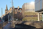
St Trinnean's School

St Trinnean's was a progressive girls' school in Edinburgh.It was founded in 1922 by its headmistress, Catherine Fraser Lee, who followed the Dalton Plan so that pupils could study what they wished and there was no homework. It was located at 10, Palmerston Road – the former home of Horatius Bonar – a minister and prodigious hymn writer. In 1925, it relocated to the grand mansion of St Leonard's Hall which had been built for the wealthy publisher, Thomas Nelson. In 1929, it had 122 day children and 38 boarders – pupils who lived at the school. When the Second World War broke out in 1939, the school evacuated to New Gala House – a mansion in Galashiels. Its pupils at that time included Jewish refugees of the Kindertransport. After the war, the school closed when Miss Fraser Lee retired in 1946.The school uniform was a pale blue tunic with fawn-coloured stockings and coat of Harris Tweed. The school was named after Saint Ninian, who was also known as Trinnean. The pupils were divided into four houses, which were named after people and places associated with the saint – Clagrinnie, Kilninian, Monenn and Whithorn. Each pupil wore a tie in the colour of their house – Kilninian was green, for example.Reunions of old pupils were held. When one was advertised in 1955, the name of the school was misprinted causing confusion with Ronald Searle's parody, St Trinian's School, which had been recently filmed as The Belles of St. Trinian's. The headmistress issued a denial that her girls were anything like those depicted by Searle. She was not happy with his portrayal, which had first appeared in 1946, when she told the school that, "After 20 years at St Trinneans, I am broken-hearted."
Excerpt from the Wikipedia article St Trinnean's School (License: CC BY-SA 3.0, Authors, Images).St Trinnean's School
The Innocent Railway, City of Edinburgh Southside
Geographical coordinates (GPS) Address Nearby Places Show on map
Geographical coordinates (GPS)
| Latitude | Longitude |
|---|---|
| N 55.94008 ° | E -3.17116 ° |
Address
Saint Leonard's Hall
The Innocent Railway
EH16 5AT City of Edinburgh, Southside
Scotland, United Kingdom
Open on Google Maps


