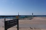
Pentwater Lake
Lakes of MichiganTributaries of Lake MichiganWest Michigan geography stubs

Pentwater Lake is a water body adjacent to the village of Pentwater, Michigan. Its primary inlet is the Pentwater River; its outlet is a man-made channel flowing into Lake Michigan. Pentwater Lake has a surface area of 431 acres (174 ha), a maximum depth of 50 feet (15 m), and an average depth of 27 feet (8.2 m). The lake contains 11,590 acre-feet (14,300,000 m3), a volume of water that would cover 18 square miles (47 km2) to a depth of 1 foot (0.30 m). Its shoreline is 6.2 miles (10.0 km) long.
Excerpt from the Wikipedia article Pentwater Lake (License: CC BY-SA 3.0, Authors, Images).Pentwater Lake
Longbridge Road, Pentwater Township
Geographical coordinates (GPS) Address Nearby Places Show on map
Geographical coordinates (GPS)
| Latitude | Longitude |
|---|---|
| N 43.7692095 ° | E -86.4212561 ° |
Address
Longbridge Road
Longbridge Road
49449 Pentwater Township
Michigan, United States
Open on Google Maps


