Mears State Park
1920 establishments in MichiganBeaches of MichiganIUCN Category IIIProtected areas established in 1920Protected areas of Oceana County, Michigan ... and 2 more
State parks of MichiganUse mdy dates from August 2023

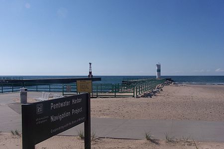
Charles Mears State Park is a public recreation area in the village of Pentwater, Oceana County, Michigan. The state park encompasses 50 acres (20 ha) on the north side of the channel that connects Lake Michigan and Pentwater Lake.
Excerpt from the Wikipedia article Mears State Park (License: CC BY-SA 3.0, Authors, Images).Mears State Park
West Lowell Street, Pentwater Township
Geographical coordinates (GPS) Address Nearby Places Show on map
Geographical coordinates (GPS)
| Latitude | Longitude |
|---|---|
| N 43.783333333333 ° | E -86.440555555556 ° |
Address
West Lowell Street
49449 Pentwater Township
Michigan, United States
Open on Google Maps


