place

Alpha Mountain

New Westminster Land DistrictPacific RangesSea-to-Sky CorridorTwo-thousanders of British Columbia
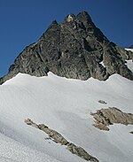
Alpha Mountain above Lake Lovely Water

Alpha Mountain is a 2,302-metre (7,552-foot) summit located in the Tantalus Range, in Tantalus Provincial Park, in southwestern British Columbia, Canada. It is situated 14 km (8.7 mi) northwest of Squamish, and 4.6 km (2.9 mi) southeast of Mount Tantalus, which is the highest peak in the Tantalus Range. Its nearest higher peak is Serratus Mountain, 1.9 km (1.2 mi) to the west. The Serratus Glacier lies to the west of Alpha, unnamed glaciers lie on the northern and eastern slopes, and Lake Lovely Water lies below the south slope. Precipitation runoff from the peak drains into tributaries of the Squamish River.

Excerpt from the Wikipedia article Alpha Mountain (License: CC BY-SA 3.0, Authors, Images).

Alpha Mountain
East Ridge Route, Area D (Elaho/Garibaldi)

Geographical coordinates (GPS) Address Nearby Places
placeShow on map

Wikipedia: Alpha MountainContinue reading on Wikipedia

Geographical coordinates (GPS)

Latitude Longitude
N 49.795555555556 ° E -123.27583333333 °
placeShow on map

Address

East Ridge Route

East Ridge Route
Area D (Elaho/Garibaldi)
British Columbia, Canada
mapOpen on Google Maps

Alpha Mountain above Lake Lovely Water
Share experience

Nearby Places

Cheakamus River
Cheakamus River

The Cheakamus River (pron. CHEEK-a-mus) is a tributary of the Squamish River, beginning on the west slopes of Outlier Peak in Garibaldi Provincial Park upstream from Cheakamus Lake on the southeastern outskirts of the resort area of Whistler. The river flows into Cheakamus Lake before exiting it and flowing northwest until it turns south and enters Daisy Lake. Between the outlet of Daisy Lake and its mouth, much of its length is spent going through Cheakamus Canyon, where the river flows through swift rapids and even one good sized waterfall. The river flows south from the lake and through the canyon before joining the Squamish River at Cheekye, a few miles north of the town of Squamish. The river's name is an anglicization of the name of Chiyakmesh ("people of the fish weir"), a village of the Squamish people and a reserve of the Squamish Nation. The c. 70 km (c.44 mi) length of the Cheakamus is followed by British Columbia Highway 99 (the Sea-to-Sky Highway) and the British Columbia Railway. The Cheakamus is a whitewater rafting and kayaking route, and is known for its steelhead and salmon fishing. Much of the flow of the upper Cheakamus is diverted from Daisy Lake beneath the mountains to the west to the Cheakamus Powerhouse on the Squamish River. Notable just north of Daisy Lake is Brandywine Falls. The Nordic events complex of the 2010 Winter Olympics was located on Callaghan Creek, a tributary of the Cheakamus just upstream from Brandywine Creek.