place

Braid Hills

Areas of EdinburghEdinburgh geography stubsHills of EdinburghParks and commons in EdinburghUse British English from December 2016
Braid Hills from Blackford Hill geograph.org.uk 929093

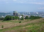
The Braid Hills form an area towards the south-western edge of Edinburgh, Scotland. The hills themselves are largely open space. Housing in the area is mostly confined to detached villas, and some large terraced houses. The Braid Hills Hotel sits above Pentland Terrace and Comiston Road, overlooking the park across the road. The area is well known for its golf course and its views of the city, and is a popular destination for families taking children sledging in the winter. There is also a riding stables and school, eastwards towards Liberton, which arranges pony trekking. Nearby areas are Morningside to the north, Comiston to the west, and Liberton to the east. The core of the name is shared with the Braid Burn and the nearby Hermitage of Braid woodland park.

Excerpt from the Wikipedia article Braid Hills (License: CC BY-SA 3.0, Authors, Images).

Braid Hills
The Ride, City of Edinburgh Braid Hills

Geographical coordinates (GPS) Address Nearby Places
placeShow on map

Wikipedia: Braid HillsContinue reading on Wikipedia

Geographical coordinates (GPS)

Latitude Longitude
N 55.912 ° E -3.197 °
placeShow on map

Address

The Ride

The Ride
EH10 6GZ City of Edinburgh, Braid Hills
Scotland, United Kingdom
mapOpen on Google Maps

Braid Hills from Blackford Hill geograph.org.uk 929093
Share experience

Nearby Places

Fairmilehead
Fairmilehead

Fairmilehead is a district of southern Edinburgh, Scotland. It lies approximately 3 miles (5 km) due south of the city centre and borders Midlothian. The area comprises the neighbourhoods of Buckstone, Caiyside, Caiystane, Swanston, Frogston and Winton. The centre of the area is the crossroads between Buckstone Terrace/Biggar Road and Frogston Road/Oxgangs Road. There was a Royal Bank of Scotland (closed October 2015) and there remains an accountant's office and a local convenience shop at the crossroads, as well as Fairmilehead Parish Church, which is a parish church of the Church of Scotland. Fairmile House Nursery and the nearby Morton Mains Farmhouse Nursery provide private childcare facilities suited to the exclusivity of the local community. This area contains some of the most expensive houses in Edinburgh, with an average home value of £362,798 and the most expensive streets being Frogston Road West (average £955,118), Margaret Rose Loan (£595,298) and Galachlaw Shot (£586,754). In 2017, the area was named by the Edinburgh Evening News as being in the top four 'happiest places to live in Edinburgh', with a 96% satisfaction rate.The eastern part of Fairmilehead contained the Princess Margaret Rose Orthopaedic Hospital from 1932 to 2002, when it was demolished to make way for new luxury housing. Recently, the Scottish Water Fairmilehead water treatment works have been converted into more high-end residential housing built by Cala and David Wilson Homes. Scottish Water retain offices there, adjacent to the Charwood Grill restaurant (previously Tusitaila Italian restaurant). The area is represented by: Scottish Parliament by Gordon MacDonald MSP (Scottish National Party), British Parliament by Ian Murray MP (Labour) On the City of Edinburgh Council (Colinton/Fairmilehead ward) by Cllrs Scott Arthur (Labour), Phil Doggart (Conservative) and Jason Rust (Conservative)

UK Astronomy Technology Centre

The UK Astronomy Technology Centre (UK ATC) is based at the Royal Observatory in Edinburgh, Scotland, and is part of the Science and Technology Facilities Council. The UK ATC designs, builds, develops, tests and manages major instrumentation projects in support of UK and international Astronomy. It has design offices, workshops and test facilities for both ground- and space-based instruments, including a suite of test labs capable of handling the largest current and projected instruments.The UK ATC was formed in 1998 in Edinburgh from the technology departments of the Royal Observatory, Edinburgh (ROE), and the Royal Greenwich Observatory, Cambridge (RGO). Its initial "customers" were the then new Gemini Observatory, the former ROE observatories in Hawaii (the James Clerk Maxwell Telescope (JCMT) and the United Kingdom Infrared Telescope (UKIRT)), and a former RGO observatory, the Isaac Newton Group on La Palma, Canary Islands. More recently, collaboration with the European Southern Observatory (ESO) and for the James Webb Space Telescope (JWST) have gained importance. Major projects and collaborations include: Several first-generation instruments for the Gemini Observatory. A mid-infrared spectrometer for the UKIRT and the Gemini Observatory. Data acquisition and reduction software for the UKIRT and the JCMT. The Wide Field Infrared Camera for the UKIRT. The Spectral and Photometric Imaging Receiver of the Herschel Space Observatory. The Visible and Infrared Survey Telescope for UK universities and ESO. A high-sensitivity, wide-field, sub-millimetre camera for the JCMT (SCUBA2). The MIRI (Mid-Infrared Instrument) for the JWST. Observing tool software for the Atacama Large Millimeter Array. Design studies for ESO's European Extremely Large Telescope. An infrared K-band multi-object spectrometer for ESO's Very Large Telescope. The European Union funded Optical Infrared Coordination Network for Astronomy (OPTICON).Following increased government emphasis on knowledge transfer and declining funds for the Science and Technology Facilities Council the UK ATC is increasingly working on projects with astronomical institutions beyond the UK and the EU, with institutions dedicated to science and technology other than astronomy, and with technology-related businesses.

Jordan Burn
Jordan Burn

The Jordan Burn, is the name of a stream, now culverted for much of its course, that runs through the Victorian suburb of Morningside in Edinburgh, Scotland, and was until 1856 the southern boundary of the city and county. It is a tributary of the Braid Burn. The Jordan first appears so named on the Roy map of Edinburgh (1753) "in obvious allusion to its position between 'Egypt' and 'Canaan'" (see below). It was originally called the Pow Burn when the Wester Burgh Muir, the area that became Morningside, was first feued by the Edinburgh magistrates in 1586. It was also popularly known in the past as the "Braid Burn", because it marked the northern boundary of the Braid Estate, but should not to be confused with its namesake above which takes a more southerly course. The Jordan rises on Craighouse Hill, then runs eastwards under Myreside Road and along the southern edge of the Royal Edinburgh Hospital grounds, where it is fed by the Comiston Burn from South Morningside, to the end of Maxwell Street. It then flows under Morningside Road between the south side of Jordan Lane and north side of Nile Grove, continuing from there under Woodburn Terrace and through the grounds of the Astley Ainslie Hospital, where it surfaces briefly. It then continues through Blackford until it reaches Mayfield, at which point it becomes known by its old name, the Pow Burn. After leaving Newington, it joins the Braid Burn at Peffermill, where it turns in a north-easterly direction. At Duddingston Mills the name changes again, this time to the Figgate Burn which enters the Firth of Forth at Portobello, having travelled a total distance of approximately ten miles.The name is one of a cluster of biblical names for lands and houses in the Morningside area. These include 'Eden', 'Paradise', 'Jordan', 'Nile', 'Salem', 'Bethel', 'Hebron', 'Goshen', and 'Zion Mount'. They seem connected in origin with a farm called 'Egypt' which stood just south of the burn where present-day Nile Grove and Woodburn Terrace meet. The farm buildings were demolished in the 1890s when the city expanded southwards on the slope of the former Burgh Muir. The farm is first mentioned in the city's Burgh Records of 1585 where it is referred to as "Littill Egypt". Since the leaders of Britain's gypsy communities often styled themselves Kings of 'Little Egypt', it has been surmised that the name indicates a gypsy presence on the muir in the 16th century when "Egyptianis" are mentioned in several official documents from the reign of James V. The lands lying immediately north of the farm, beyond the Jordan Burn, are described as "Canaan", in the Burgh Records of 1661, suggesting the initial spread of names with biblical associations. These appear to have proliferated in the Victorian period, being very likely added by Bible-conscious residents of the expanding suburb of Morningside who wished to perpetuate the tradition; so much so that it contributed to the district's reputation of being the city's "Bible Belt".As late as the mid-1960s, the author of a survey of Edinburgh wrote of the community in Morningside that, ...respect is due to this disciplined if stolid army of South Edinburgh, repairing each week in satins and 'stands' of Sabbath broadcloth to its respective persuasions at 'Holy Corner', (Churchhill) and similar ecclesiastical meccas, and in the pleasant Sunday afternoons making pilgrimages to the large, airy, orderly and flowery cemeteries of Grange, Morningside and Newington. This society sent many of its sons and daughters to settle in New Zealand (among other regions) and to graft the names and cultures of home into places like Dunedin. Its influence has been truly world-wide. So, if an Empire has been lost, this cannot be laid at Morningside's door. Moreover, the influence of its missionary zeal upon the benighted heathen has probably been greater than that of any comparable area on earth.