place

Fort River

AC with 0 elementsGeography of Amherst, MassachusettsGeography of New EnglandRivers of Franklin County, MassachusettsRivers of Hampshire County, Massachusetts
Rivers of MassachusettsTributaries of the Connecticut River

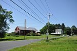
The Fort River is a river in Western Massachusetts and is a tributary of the Connecticut River and runs through the towns of, Amherst, Massachusetts, and ends in Hadley, Massachusetts.The Fort technically begins as Adams Brook which begins at a pond near Atkin's Reservoir in Shutesbury, Massachusetts (however the ponds aren't part of the reservoir), and flows south-west ward until it reaches the spot where Amythest Brook flows into it, where it becomes the "Fort River." Although it has no dams or man-made things on the river, some of the Fort's tributaries have reservoirs. The Fort River has a wide variety of wildlife due to it being the longest free-flowing tributary (having no dams or other man made changes made to the rivers shape or flow) of the Connecticut River. Because of this there is a lot of wildlife making it one of the 3 most diverse rivers in the state. Mussels, Eastern Pearlfish, Sea Lampreys, and American Eel's.

Excerpt from the Wikipedia article Fort River (License: CC BY-SA 3.0, Authors).

Fort River
Middle Street,

Geographical coordinates (GPS) Address Nearby Places
placeShow on map

Wikipedia: Fort RiverContinue reading on Wikipedia

Geographical coordinates (GPS)

Latitude Longitude
N 42.3261 ° E -72.5843 °
placeShow on map

Address

Middle Street 236
01035
Massachusetts, United States
mapOpen on Google Maps

Share experience

Nearby Places

Hadley Center Historic District

The Hadley Center Historic District is an expansive, 2,500-acre (1,000 ha) historic district encompassing the village center of Hadley, Massachusetts. When it was first listed on the National Register of Historic Places in 1977, the district encompassed the town green and 17 buildings that faced it, at the junction of Russell Street (Massachusetts Route 9) and Middle Street (Massachusetts Route 47). The district was expanded significantly in 1994, adding more than 400 buildings representative of the village's growth from colonial days into the first decades of the 20th century. This expansion encompasses the entirety of a tongue of land extending west from East Street and bounded by a bend in the Connecticut River, which separates Hadley from Northampton. Its oldest property, the Samuel Porter House on West Street, was built in 1713.Hadley was settled in 1659 and incorporated as a town in 1661. The land use patterns laid out at that time are still evident in the area surrounding the town center. The agricultural areas of the tongue of land in the Connecticut River floodplain were laid out in narrow strips, generally oriented north-south, which still dominate land ownership and usage patterns. Its major roads, including Russell, East, Middle, and West Streets, were laid out around this time, and were where houses and civic institutions were built. Bay Road, formerly a Native American trail, was the major road heading east from the river. The town grew slowly until the early 19th century, when it was joined to Northampton by a bridge over the Connecticut River. It remained agricultural, with a few cottage industries, with tobacco a major 19th-century crop before market gardens came to dominate in the early 20th century. The town center's architecture is reflective of its slow growth, with instances of architectural styles spanning more than three centuries.

Pioneer Valley
Pioneer Valley

The Pioneer Valley is the colloquial and promotional name for the portion of the Connecticut River Valley that is in Massachusetts in the United States. It is generally taken to comprise the three counties of Hampden, Hampshire, and Franklin. The lower Pioneer Valley corresponds to the Springfield, Massachusetts metropolitan area, the region's urban center, and the seat of Hampden County. The upper Pioneer Valley region includes the smaller cities of Northampton and Greenfield, the county seats of Hampshire and Franklin counties, respectively. Historically the northern part of the Valley was an agricultural region, known for growing Connecticut shade tobacco and other specialty crops like Hadley asparagus; however, since the late 19th century its economy has become increasingly a knowledge economy, due to the prominence of the Five Colleges in Hampshire County. Similarly the Springfield-Chicopee-Holyoke economies transformed from volume producers of goods such as paper and armaments, into a combination of specialized manufacturing and distribution services for Boston and New York. Many of the cities and towns include areas of forests, and Springfield itself, which in the early twentieth century was nicknamed "The City in a Forest," features nature within its city limits and over 12% parkland. The Pioneer Valley is known for its scenery and as a vacation destination. The Holyoke Range, Mount Tom Range, and numerous rolling hills, bluffs, and meadows feature extravagant homes from the Gilded Age, many of which surround New England's longest and largest river, the Connecticut River, which flows through the region.The name Pioneer Valley originates in the 20th century with travel writers using it in the 1920s and 1930s to designate the region. In 1939 the Pioneer Valley Association was formed to promote the region using that name.

Hockanum Rural Historic District

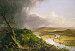
Hockanum Rural Historic District is a rural historic district along the Connecticut River in Hadley, Massachusetts. The district includes much of the area in Hadley west of Mount Holyoke and east of the river. Its formal boundaries run from Hockanum Cemetery in the southwest, following the river and the summit ridge of Mount Holyoke to the northeast corner of J.A. Skinner State Park. It includes the summit area of Mount Holyoke, including the Summit House, Halfway House, and other historic structures within the park, along with the agricultural lands of the valley below.The views of the Connecticut River valley from Mount Holyoke were popularized in the early 19th century by the writing of Timothy Dwight, a Northampton native and president of Yale College. The summit area was a tourist destination, and artists such as Thomas Cole immortalized the views in art. In the late 19th century tourism waned, but saw a brief resurgence in the 1910s and 1920s due to the activities of Joseph Skinner, a local industrialist and philanthropist. He purchased and rehabilitated the mountaintop facilities and modernized the road to the summit. His success was brief, hurt by the Great Depression and the effects of the 1938 New England hurricane, which nearly destroyed the Summit House. He donated his holdings to the state to form the core of Skinner State Park.The agricultural lands in the valley have undergone only relatively modest changes, and farming continues to be a dominant activity in the area. Most of the structures in the valley are related to agricultural activities. There is no church, but the community has historically been focused around taverns that were in the area, and more recently around the Hockanum School, a small brick schoolhouse built c. 1853.The district was added to the National Register of Historic Places in 1993.