Harrestrup Å
Denmark geography stubsEurope river stubsGeography of CopenhagenParks and open spaces in CopenhagenParks in Albertslund Municipality ... and 2 more
Rivers of ZealandRivers of the Øresund Region

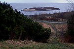
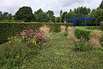
Harrestrup Å is an approximately 20 km long stream through the western suburbs of Copenhagen, Denmark. It rises at Harrestrup Mose in Vestskoven woodland on the border between Albertslund and Ballerup and flows through Damhus Lake and several parks on its way to the Øresund at Kalvebod Beach in Valby Park.
Excerpt from the Wikipedia article Harrestrup Å (License: CC BY-SA 3.0, Authors, Images).Harrestrup Å
Engstykkevej, Hvidovre Municipality
Geographical coordinates (GPS) Address Nearby Places Show on map
Geographical coordinates (GPS)
| Latitude | Longitude |
|---|---|
| N 55.6359 ° | E 12.5067 ° |
Address
Renseanlæg Damhusåen
Engstykkevej
2500 Hvidovre Municipality
Capital Region of Denmark, Denmark
Open on Google Maps


