Denmark–Sweden border
1658 establishments in Denmark1658 establishments in Sweden1658 in international relationsBaltic SeaBorders of Denmark ... and 5 more
Borders of SwedenDenmark–Sweden borderEuropean Union internal bordersInternational bordersKattegat

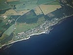
The current national border between Denmark and Sweden dates to 1658. It is entirely a maritime border, along Kattegat and Øresund, and in the Baltic Sea between Bornholm and Scania. The territorial waters (12 mile zone) of the two countries meet exclusively along the Øresund, extending to about 115 kilometres (71 mi), approximately between Höganäs and Falsterbo. There is one road and rail connection, the 16 kilometres (9.9 mi) long Øresund fixed link, opened in 2000, besides a number of ferry links.
Excerpt from the Wikipedia article Denmark–Sweden border (License: CC BY-SA 3.0, Authors, Images).Denmark–Sweden border
Helsingborgs kommun
Geographical coordinates (GPS) Address Nearby Places Show on map
Geographical coordinates (GPS)
| Latitude | Longitude |
|---|---|
| N 56.1 ° | E 12.583333333333 ° |
Address
Domsten
254 78 Helsingborgs kommun
Sweden
Open on Google Maps


