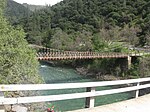
Sugar Pine Reservoir
Central Valley ProjectReservoirs in CaliforniaReservoirs in Northern CaliforniaReservoirs in Placer County, California

Sugar Pine Reservoir is a reservoir in Placer County, California, located approximately 7 miles (11 km) north of Foresthill. The reservoir was flooded in 1982, and today supplies water to the community of Foresthill and hosts a number of recreation facilities.
Excerpt from the Wikipedia article Sugar Pine Reservoir (License: CC BY-SA 3.0, Authors, Images).Sugar Pine Reservoir
Joshua M. Hardt Memorial Trail,
Geographical coordinates (GPS) Address Nearby Places Show on map
Geographical coordinates (GPS)
| Latitude | Longitude |
|---|---|
| N 39.133888888889 ° | E -120.79222222222 ° |
Address
Joshua M. Hardt Memorial Trail
Joshua M. Hardt Memorial Trail
California, United States
Open on Google Maps


