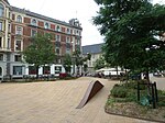
Stormgade
Streets in Copenhagen

Stormgade (lit. "Storm Street") is a street in central Copenhagen, Denmark. It runs from Frederiksholm Canal to H. C. Andersens Boulevard where it turns into Tietgensgade before continuing along the rear side of Tivoli Gardens and Copenhagen Central Station. In the opposite direction, Storm Bridge connects it to Slotsholmen where traffic may continue across Holmen's Bridge to Holmens Kanal, part of Ring 2, or across Knippel's Bridge to Christianshavn and Amager. The name of the street refers to the Swedish Storm of Copenhagen in 1659.
Excerpt from the Wikipedia article Stormgade (License: CC BY-SA 3.0, Authors, Images).Stormgade
Ny Vestergade, Copenhagen Christianshavn
Geographical coordinates (GPS) Address Phone number Website Nearby Places Show on map
Geographical coordinates (GPS)
| Latitude | Longitude |
|---|---|
| N 55.6744 ° | E 12.5736 ° |
Address
Nationalmuseet (Prinsens Palæ)
Ny Vestergade
1471 Copenhagen, Christianshavn
Capital Region of Denmark, Denmark
Open on Google Maps


