place

Hensbarrow

Cornwall geography stubsGeography of CornwallMoorlands of CornwallNatural regions of England
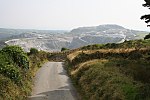
Hensbarrow Downs geograph.org.uk 851791

Hensbarrow is a natural region in the county of Cornwall, England, UK, that has been recognized as National Character Area 154 by Natural England. Hensbarrow is an upland region covering an area of just under 12,000 hectares immediately north of St Austell. It is bounded in the north by the A30 road and runs from Retew and Treviscoe in the west to Redmoor and Penpillick in the east. It is the remnant of a much larger exposed and windswept heather moorland. Its lower, more sheltered areas are covered by irregular livestock fields enclosed by Cornish hedges of stone walls, with scattered hamlets and farmsteads. China clay pits, sand tips and mica dams occupy much of the central area. Its highest point is Hensbarrow Beacon (1025 ft).

Excerpt from the Wikipedia article Hensbarrow (License: CC BY-SA 3.0, Authors, Images).

Hensbarrow
St Austell to A30 Link Road,

Geographical coordinates (GPS) Address Nearby Places
placeShow on map

Wikipedia: HensbarrowContinue reading on Wikipedia

Geographical coordinates (GPS)

Latitude Longitude
N 50.3872 ° E -4.8221 °
placeShow on map

Address

St Austell to A30 Link Road

St Austell to A30 Link Road
PL26 8ZL , Roche
England, United Kingdom
mapOpen on Google Maps

Hensbarrow Downs geograph.org.uk 851791
Share experience

Nearby Places

Gover Stream
Gover Stream

The Gover Stream (Cornish: Gover, meaning stream) is an approximately 3 kilometres (1.9 mi) long stream located in mid south Cornwall, England, United Kingdom. The source of the stream is at the north eastern side of Blackpool China clay pit at grid reference SW 980 540 . The stream flows south east through the Gover Valley into the town of St Austell where it joins the St Austell River or "White River". The Gover Stream is the first of the two largest tributaries of the St Austell River. Rivers in the area have problems with china clay waste materials, mostly kaolinite, entering the rivers and turning them white. This led to the locally named "White River". (Kaolinite is not a waste material of the quarrying process, but economically not all of the kaolin can be extracted). Suspended particles in the stream are reduced by approximately 98% by settling tanks at the beginning of the river. This reduces the energy of the water in the tanks and allows suspended particles to be deposited and later dredged by diggers. Several disused china clay dries are located along the stream showing its past industrial importance. There were also plans to extend the Pentewan railway along the valley from St Austell, but they did not come to fruition. Recently the Gover Valley has been under threat due to a plan to use the valley as a tipping site for china clay waste. Waste is a huge problem in the area as for every tonne of kaolinite produced there are on average nine tonnes of waste materials produced; this amounts to approximately 20 million tonnes of waste materials per year. An area of 1 square kilometre (250 acres) is planned to be tipped on which would destroy the upper section of the Gover Stream as well as ancient farmland and woodland. The tip will be landscaped once completed.